
Chimaltenango
21 known cemeteries in Chimaltenango, Guatemala.
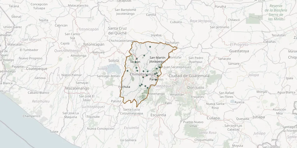 © OpenStreetMap
- Acatenango General CemeteryGPS coordinates: 14.55424° N, 90.94867° W
- Bola de Oro Communal CemeteryGPS coordinates: 14.70200° N, 90.79972° W
- Cerritos Communal CemeteryGPS coordinates: 14.68345° N, 90.97350° W
- Chichoy Alto Paraíso Hamlet Municipal CemeteryGPS coordinates: 14.68269° N, 91.06063° W
- Chimaltenango General CemeteryGPS coordinates: 14.65628° N, 90.81540° W
- El Tejar Municipal Cemetery, ChimaltenangoGPS coordinates: 14.64086° N, 90.79296° W
- General Cemetery Santa ApoloniaGPS coordinates: 14.78657° N, 90.97759° W
- Joya Grande CemeteryGPS coordinates: 14.67867° N, 90.88162° W
- La Soledad CemeteryGPS coordinates: 14.53660° N, 90.88289° W
- Los Pinos CemeteryGPS coordinates: 14.66359° N, 90.79999° W
- Pajales II CemeteryGPS coordinates: 14.55167° N, 90.90145° W
- Parramos Municipal CemeteryGPS coordinates: 14.60596° N, 90.80862° W
- Patzicia Municipal CemeteryGPS coordinates: 14.62691° N, 90.92102° W
- Paxorotot CemeteryGPS coordinates: 14.70923° N, 90.98082° W
- Rosario Canajal General CemeteryGPS coordinates: 14.89018° N, 90.85944° W
- San Antonio Nejapa General CemeteryGPS coordinates: 14.56499° N, 90.93404° W
- San Jacinto Communal CemeteryGPS coordinates: 14.71387° N, 90.77455° W
- San José Poaquil General CemeteryGPS coordinates: 14.81481° N, 90.91146° W
- Santa Cruz Balanyá Municipal CemeteryGPS coordinates: 14.67902° N, 90.91864° W
- Tecpán Municipal CemeteryGPS coordinates: 14.75893° N, 90.98759° W
- Zaragoza Municipal CemeteryGPS coordinates: 14.64375° N, 90.88915° W