
Chiquimula
16 known cemeteries in Chiquimula, Guatemala.
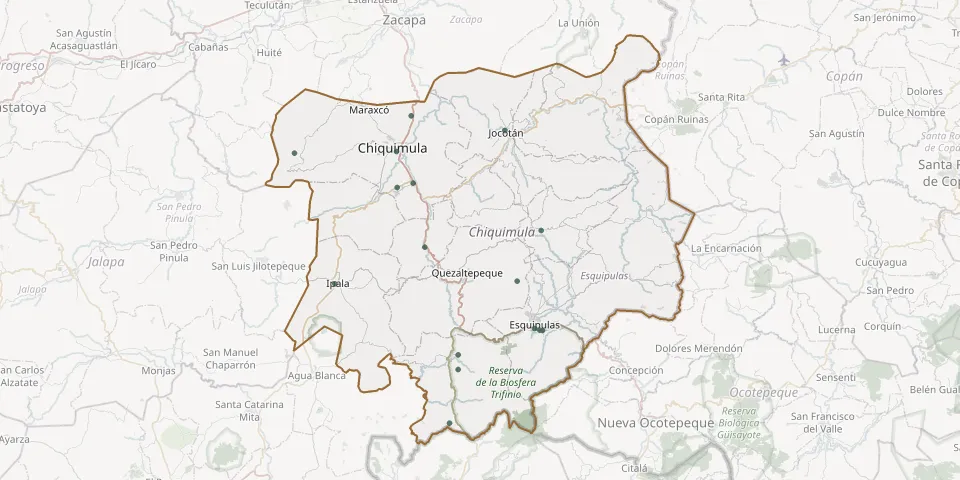 © OpenStreetMap
- Alambrados Community CemeteryGPS coordinates: 14.43474° N, 89.46796° W
- Chiramay CemeteryGPS coordinates: 14.62359° N, 89.37502° W
- Concepción las Minas Municipal CemeteryGPS coordinates: 14.52560° N, 89.45630° W
- El Barreal Village Cemetery, ChiquimulaGPS coordinates: 14.79346° N, 89.68107° W
- El Ingeniero Village General CemeteryGPS coordinates: 14.84286° N, 89.52054° W
- Esquipulas General CemeteryGPS coordinates: 14.56062° N, 89.35123° W
- Ipala Municipal CemeteryGPS coordinates: 14.61973° N, 89.62541° W
- Jocotán General CemeteryGPS coordinates: 14.82369° N, 89.39187° W
- Las Crucitas CemeteryGPS coordinates: 14.55768° N, 89.34019° W
- Los Milagros CemeteryGPS coordinates: 14.55836° N, 89.34420° W
- Municipal, ChiquimulaGPS coordinates: 14.79568° N, 89.54096° W
- Olopa Municipal CemeteryGPS coordinates: 14.69064° N, 89.34214° W
- Ornito CemeteryGPS coordinates: 14.50598° N, 89.45639° W
- Sabana Grande General CemeteryGPS coordinates: 14.74800° N, 89.54015° W
- San Esteban Village CemeteryGPS coordinates: 14.75366° N, 89.51780° W
- San Jacinto CemeteryGPS coordinates: 14.66882° N, 89.50212° W