
Jutiapa
23 known cemeteries in Jutiapa, Guatemala.
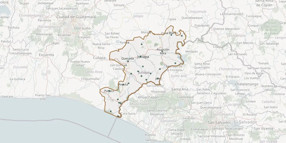 © OpenStreetMap
- Asuncion Mita CemeteryGPS coordinates: 14.33408° N, 89.71982° W
- Atescatempa CemeteryGPS coordinates: 14.17498° N, 89.74001° W
- Cerro Gordo CemeteryGPS coordinates: 14.28629° N, 89.92067° W
- Ciudad Pedro de Alvarado Cemetery, Moyuta, JutiapaGPS coordinates: 13.86956° N, 90.10135° W
- Comapa General CemeteryGPS coordinates: 14.11130° N, 89.91020° W
- Conguaco CemeteryGPS coordinates: 14.04775° N, 90.02924° W
- El Amatón CemeteryGPS coordinates: 14.24518° N, 90.03486° W
- El Paraíso Los Tamarindos CemeteryGPS coordinates: 13.79693° N, 90.19414° W
- Encino Gacho Local CemeteryGPS coordinates: 14.39679° N, 89.90886° W
- Estanzuela CemeteryGPS coordinates: 14.08019° N, 89.86569° W
- Flor de leche CemeteryGPS coordinates: 14.15475° N, 89.94125° W
- Garita Chapina CemeteryGPS coordinates: 13.75242° N, 90.12593° W
- Jalpatagua General CemeteryGPS coordinates: 14.13264° N, 90.00440° W
- La Esmeralda CemeteryGPS coordinates: 14.09101° N, 89.75867° W
- Las Cañas CemeteryGPS coordinates: 14.47206° N, 89.53878° W
- Moyuta Municipal CemeteryGPS coordinates: 14.03619° N, 90.07743° W
- Palos Abrazados CemeteryGPS coordinates: 13.90284° N, 90.12787° W
- Panalvia Village CemeteryGPS coordinates: 14.48025° N, 89.63510° W
- Pasaco General CemeteryGPS coordinates: 13.97993° N, 90.20825° W
- Potrero Grande CemeteryGPS coordinates: 14.19809° N, 89.89713° W
- Poza del Llano Village CemeteryGPS coordinates: 13.87321° N, 90.11670° W
- Sitio de las Flores CemeteryGPS coordinates: 14.22726° N, 89.59781° W
- Zapotitlán Local CemeteryGPS coordinates: 14.13586° N, 89.82585° W