
Retalhuleu
15 known cemeteries in Retalhuleu, Guatemala.
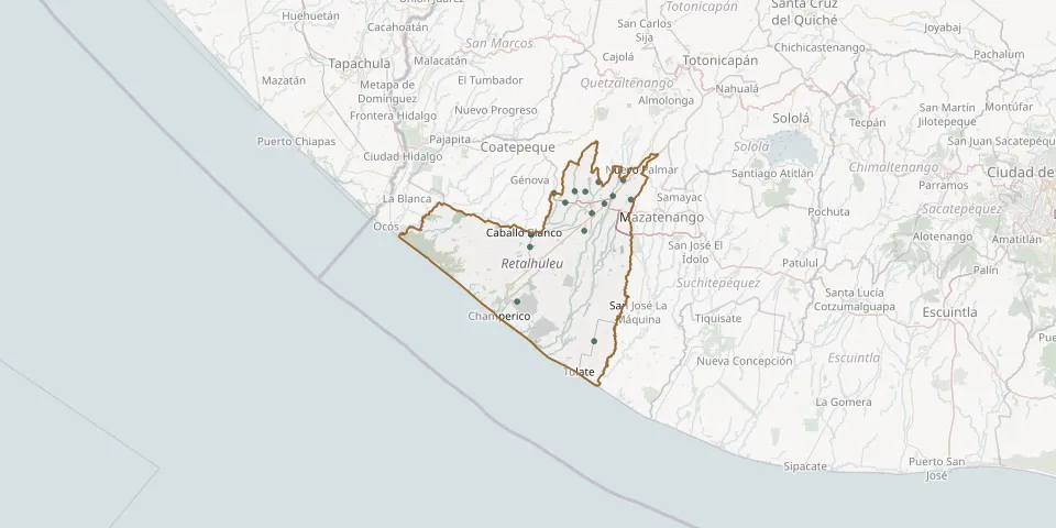 © OpenStreetMap
- Barrios Village General CemeteryGPS coordinates: 14.61740° N, 91.66412° W
- Caballo Blanco CemeteryGPS coordinates: 14.48984° N, 91.83242° W
- Cantón Copepé CemeteryGPS coordinates: 14.49897° N, 91.70048° W
- Cemetario near CuyotenangoGPS coordinates: 14.54205° N, 91.68089° W
- Centre 2 General Cemetery, La MáquinaGPS coordinates: 14.23260° N, 91.67554° W
- El Asintal General CemeteryGPS coordinates: 14.59534° N, 91.72387° W
- El Pijuy Sector CemeteryGPS coordinates: 14.32863° N, 91.86770° W
- El Xab General Cemetery, near RetalhuleuGPS coordinates: 14.59110° N, 91.77625° W
- Nuevo San Carlos General CemeteryGPS coordinates: 14.59381° N, 91.69748° W
- San Andrés Villa Seca Public CemeteryGPS coordinates: 14.57494° N, 91.58364° W
- San Felipe General CemeteryGPS coordinates: 14.62176° N, 91.60269° W
- San Sebastian CemeteryGPS coordinates: 14.56502° N, 91.64981° W
- Santa Cruz Mulua CemeteryGPS coordinates: 14.58322° N, 91.62902° W
- Santa Fe CemeteryGPS coordinates: 14.46044° N, 91.83576° W
- Sibana CemeteryGPS coordinates: 14.56808° N, 91.74741° W