
Sacatepéquez
17 known cemeteries in Sacatepéquez, Guatemala.
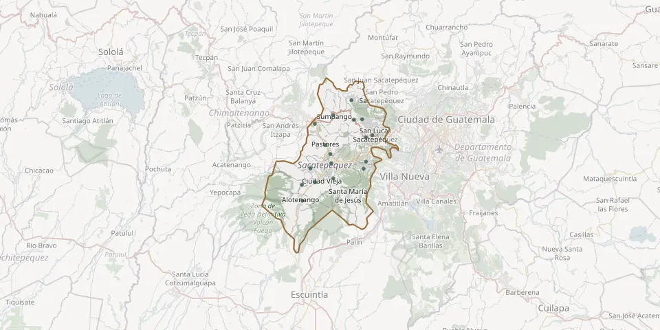 © OpenStreetMap
- Alotenango CemeteryGPS coordinates: 14.48426° N, 90.80129° W
- Ciudad Vieja General CemeteryGPS coordinates: 14.51981° N, 90.77553° W
- Jocotenango CemeteryGPS coordinates: 14.57409° N, 90.74519° W
- Magdalena Milpas Altas Municipal CemeteryGPS coordinates: 14.54580° N, 90.67864° W
- Pastores General CemeteryGPS coordinates: 14.59161° N, 90.75478° W
- San Antonio Aguas Calientes CemeteryGPS coordinates: 14.54668° N, 90.78523° W
- San Bartolomé Milpas Altas Municipal CemeteryGPS coordinates: 14.60654° N, 90.67425° W
- San Lázaro General CemeteryGPS coordinates: 14.55663° N, 90.74346° W
- San Lucas General CemeteryGPS coordinates: 14.61108° N, 90.66161° W
- San Miguel Dueñas CemeteryGPS coordinates: 14.51507° N, 90.80190° W
- San Miguel Morazán Municipal CemeteryGPS coordinates: 14.63291° N, 90.77640° W
- San Pedro Las Huertas CemeteryGPS coordinates: 14.52724° N, 90.73914° W
- Santa María Cauqué General CemeteryGPS coordinates: 14.64094° N, 90.69821° W
- Santiago Sacatepéquez CemeteryGPS coordinates: 14.64139° N, 90.68175° W
- Santo Domingo Xenacoj Municipal CemeteryGPS coordinates: 14.67828° N, 90.70309° W
- Santo Tomas Milpas Altas CemeteryGPS coordinates: 14.55966° N, 90.67444° W
- Sumpango Municipal CemeteryGPS coordinates: 14.64978° N, 90.73947° W