
Cortés
21 known cemeteries in Cortés, Honduras.
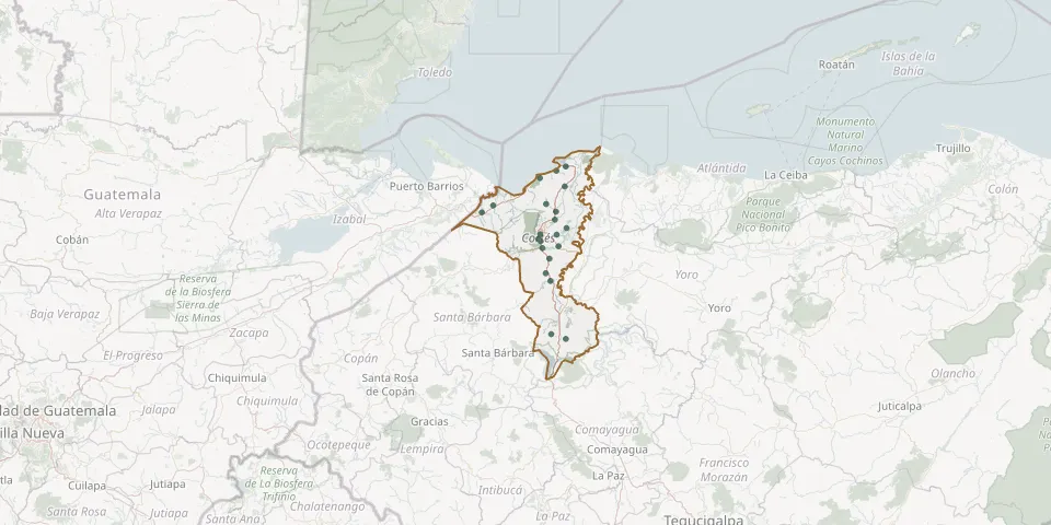 © OpenStreetMap
- Caridad del Cobre Memorial Park CemeteryGPS coordinates: 15.82404° N, 87.89804° W
- Chamelecon CemeteryGPS coordinates: 15.42856° N, 88.01567° W
- Choloma General CemeteryGPS coordinates: 15.60541° N, 87.94829° W
- Cieneguita CemeteryGPS coordinates: 15.80354° N, 87.94615° W
- Cortés CemeteryGPS coordinates: 15.60274° N, 88.31980° W
- Dos Caminos New CemeteryGPS coordinates: 15.37747° N, 87.98056° W
- Gardens of Eternity Cemetery, Palos VerdesGPS coordinates: 15.46326° N, 88.02468° W
- La Jutosa General CemeteryGPS coordinates: 15.64302° N, 87.99688° W
- Lima Vieja CemeteryGPS coordinates: 15.43788° N, 87.93379° W
- López Arellano CemeteryGPS coordinates: 15.56659° N, 87.95279° W
- Los Laureles CemeteryGPS coordinates: 15.49476° N, 87.94395° W
- Omoa CemeteryGPS coordinates: 15.76746° N, 88.02747° W
- Pimienta Municipal CemeteryGPS coordinates: 15.27019° N, 87.97489° W
- Plantel Hondutel La Puerta CemeteryGPS coordinates: 15.47259° N, 88.03511° W
- Rio Blanquito CemeteryGPS coordinates: 15.72682° N, 87.90320° W
- San Francisco de Yojoa Municipal CemeteryGPS coordinates: 15.01276° N, 87.97073° W
- San José del Boquerón CemeteryGPS coordinates: 15.52529° N, 87.89341° W
- San Pedro Apóstol General CemeteryGPS coordinates: 15.49681° N, 88.02683° W
- Santa Cruz CemeteryGPS coordinates: 14.98920° N, 87.89764° W
- Tegucigalpita CemeteryGPS coordinates: 15.63610° N, 88.26173° W
- Villanueva CemeteryGPS coordinates: 15.30659° N, 87.99894° W