
Olancho
22 known cemeteries in Olancho, Honduras.
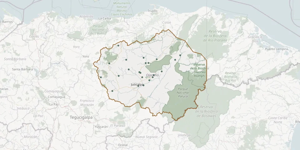 © OpenStreetMap
- Arimís Old CemeteryGPS coordinates: 14.73402° N, 86.00799° W
- Campamento CemeteryGPS coordinates: 14.55128° N, 86.65749° W
- Chindona CemeteryGPS coordinates: 15.11564° N, 86.10888° W
- Dulce Nombre de Culmi CemeteryGPS coordinates: 15.08016° N, 85.55485° W
- El Morroco CemeteryGPS coordinates: 15.02733° N, 86.02274° W
- Esquipulas del Norte Olancho Municipal CemeteryGPS coordinates: 15.32381° N, 86.55453° W
- General El Guayabito CemeteryGPS coordinates: 14.78547° N, 85.94944° W
- Gualaco General CemeteryGPS coordinates: 15.02596° N, 86.07324° W
- Guancoca Communal CemeteryGPS coordinates: 14.78605° N, 86.13364° W
- Guata Municipal CemeteryGPS coordinates: 15.08356° N, 86.41468° W
- Guayape Municipal CemeteryGPS coordinates: 14.78369° N, 86.85917° W
- La Concepción CemeteryGPS coordinates: 14.63750° N, 86.20276° W
- La Unión Municipal Cemetery, OlanchoGPS coordinates: 15.02114° N, 86.71298° W
- La Venta CemeteryGPS coordinates: 15.09142° N, 85.87740° W
- Los Amates CemeteryGPS coordinates: 14.88469° N, 85.79055° W
- Manto CemeteryGPS coordinates: 14.91810° N, 86.37078° W
- Olancho CemeteryGPS coordinates: 14.85913° N, 86.16382° W
- Pisijire CemeteryGPS coordinates: 15.15791° N, 85.46599° W
- San Francisco de Becerra CemeteryGPS coordinates: 14.64725° N, 86.11019° W
- San Francisco de la Paz Municipal CemeteryGPS coordinates: 14.87269° N, 86.18337° W
- Santa María del Real Municipal CemeteryGPS coordinates: 14.82263° N, 85.92876° W
- Silca Municipal Cemetery, OlanchoGPS coordinates: 14.80854° N, 86.54660° W