
Yoro
14 known cemeteries in Yoro, Honduras.
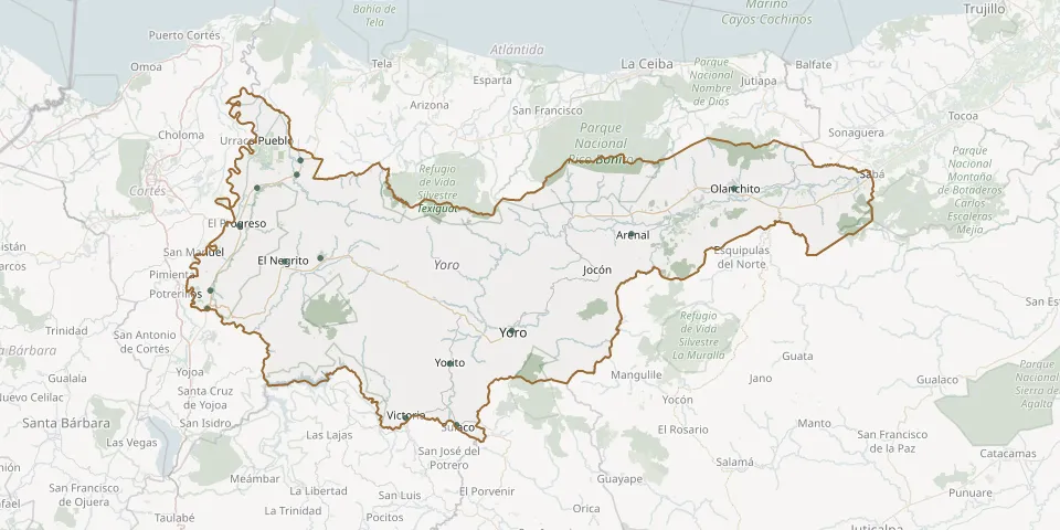 © OpenStreetMap
- Agua Blanca Sur Local CemeteryGPS coordinates: 15.23927° N, 87.87893° W
- Arenal Municipal CemeteryGPS coordinates: 15.37528° N, 86.83177° W
- El Negrito CemeteryGPS coordinates: 15.30871° N, 87.69338° W
- El Progreso Municipal CemeteryGPS coordinates: 15.39439° N, 87.80664° W
- Guaymón CemeteryGPS coordinates: 15.51697° N, 87.66362° W
- Jardines de Amor Eterno CemeteryGPS coordinates: 15.48556° N, 87.76274° W
- Morazán General CemeteryGPS coordinates: 15.31717° N, 87.60459° W
- Olanchito Municipal CemeteryGPS coordinates: 15.48325° N, 86.57551° W
- Santa Rita Yoro CemeteryGPS coordinates: 15.19625° N, 87.88565° W
- Sulaco General CemeteryGPS coordinates: 14.91626° N, 87.26653° W
- Toyós CemeteryGPS coordinates: 15.55148° N, 87.65414° W
- Victoria Yoro Municipal CemeteryGPS coordinates: 14.93347° N, 87.39261° W
- Yorito Municipal CemeteryGPS coordinates: 15.06348° N, 87.28290° W
- Yoro Municipal CemeteryGPS coordinates: 15.14290° N, 87.12909° W