
Győr-Moson-Sopron
248 known cemeteries in Győr-Moson-Sopron, Hungary.
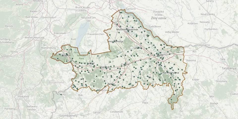 © OpenStreetMap
- Balfi út Evangelical Cemetery, SopronGPS coordinates: 47.68398° N, 16.60702° E
- St. Michael Cemetery (old), SopronGPS coordinates: 47.68766° N, 16.59981° E
- Bánfalva Heroes' CemeteryGPS coordinates: 47.67790° N, 16.55511° E
- Beled CemeteryGPS coordinates: 47.46249° N, 17.10505° E
- Sopron CemeteryGPS coordinates: 47.69102° N, 16.59791° E
- Csikvánd CemeteryGPS coordinates: 47.46691° N, 17.45938° E
- Hegyeshalom CemeteryGPS coordinates: 47.91178° N, 17.16085° E
- Sokorópátka CemeteryGPS coordinates: 47.49565° N, 17.68895° E
- Fertőrákos CemeteryGPS coordinates: 47.72460° N, 16.64940° E
- Harka CemeteryGPS coordinates: 47.63620° N, 16.60088° E
- Újkér Szopor CemeteryGPS coordinates: 47.45086° N, 16.81943° E
- Nagycenk CemeteryGPS coordinates: 47.60149° N, 16.69748° E
- Petöháza CemeteryGPS coordinates: 47.59335° N, 16.90097° E
- Hegykő CemeteryGPS coordinates: 47.61988° N, 16.80148° E
- Pereszteg CemeteryGPS coordinates: 47.59045° N, 16.72480° E
- Nádorváros Public CemeteryGPS coordinates: 47.66185° N, 17.64322° E
- Sopronkövesd CemeteryGPS coordinates: 47.54730° N, 16.75030° E
- Balf CemeteryGPS coordinates: 47.65545° N, 16.66335° E
- Rábaszentandrás CemeteryGPS coordinates: 47.45594° N, 17.33498° E
- Röjtökmuzsaj (Röjtök) CemeteryGPS coordinates: 47.55409° N, 16.84358° E
- Keresztény Cemetery, EgyházasfaluGPS coordinates: 47.45395° N, 16.77025° E
- Újkér CemeteryGPS coordinates: 47.46117° N, 16.81170° E
- Kunsziget CemeteryGPS coordinates: 47.73832° N, 17.51183° E
- Pinnye CemeteryGPS coordinates: 47.58928° N, 16.76968° E
- Sopron Jewish CemeteryGPS coordinates: 47.68990° N, 16.60190° E
- Fertőhomok CemeteryGPS coordinates: 47.62123° N, 16.76413° E
- Ebergőc CemeteryGPS coordinates: 47.56042° N, 16.80482° E
- Hidegség CemeteryGPS coordinates: 47.62490° N, 16.74376° E
- Nagylózs CemeteryGPS coordinates: 47.56112° N, 16.76600° E
- Sobor CemeteryGPS coordinates: 47.47837° N, 17.36721° E