
Komárom-Esztergom
115 known cemeteries in Komárom-Esztergom, Hungary.
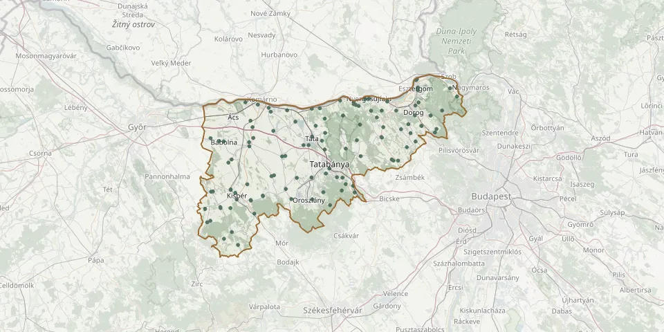 © OpenStreetMap
- Réde Catholic CemeteryGPS coordinates: 47.42768° N, 17.91126° E
- Sárisáp Public CemeteryGPS coordinates: 47.67739° N, 18.68161° E
- Síkvölgy CemeteryGPS coordinates: 47.55857° N, 18.38325° E
- St. Anne (Csalamádé) Cemetery, Téglaházi DűlőGPS coordinates: 47.78103° N, 18.74836° E
- Súr CemeteryGPS coordinates: 47.36674° N, 18.03441° E
- Süttő CemeteryGPS coordinates: 47.75368° N, 18.44007° E
- Szárliget CemeteryGPS coordinates: 47.52533° N, 18.49104° E
- Szárliget New CemeteryGPS coordinates: 47.50804° N, 18.49734° E
- Szentgyörgymező CemeteryGPS coordinates: 47.80810° N, 18.74113° E
- Szomód CemeteryGPS coordinates: 47.68609° N, 18.34267° E
- Szomor CemeteryGPS coordinates: 47.59336° N, 18.66940° E
- Tarján CemeteryGPS coordinates: 47.60513° N, 18.52075° E
- Tárkány CemeteryGPS coordinates: 47.59626° N, 18.00832° E
- Tata Cemetery, Környei Street 20GPS coordinates: 47.63470° N, 18.31389° E
- Tatai út Cemetery, KomáromGPS coordinates: 47.72366° N, 18.16420° E
- Tokod CemeteryGPS coordinates: 47.72689° N, 18.66252° E
- Újbánhida CemeteryGPS coordinates: 47.57235° N, 18.39634° E
- Újtelep Old CemeteryGPS coordinates: 47.46608° N, 17.96481° E
- Úny CemeteryGPS coordinates: 47.64432° N, 18.73903° E
- Vérteskethely Catholic CemeteryGPS coordinates: 47.48658° N, 18.08555° E
- Vérteskethely Reformed CemeteryGPS coordinates: 47.48721° N, 18.08459° E
- Vértessomló CemeteryGPS coordinates: 47.50837° N, 18.37263° E
- Vértesszőlős CemeteryGPS coordinates: 47.62274° N, 18.37795° E
- Vértestolna CemeteryGPS coordinates: 47.62499° N, 18.46192° E
- Zrínyi Miklós Street Cemetery, BanaGPS coordinates: 47.65336° N, 17.92546° E