
Kerman
78 known cemeteries in Kerman, Iran.
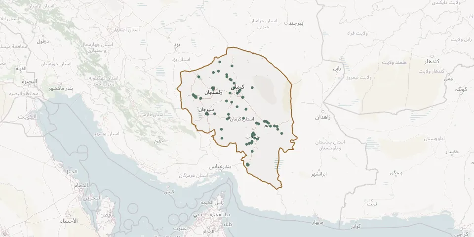 © OpenStreetMap
- Abbasabad Behesht-e Zahra CemeteryGPS coordinates: 29.69098° N, 57.04182° E
- Abdolabad CemeteryGPS coordinates: 30.07580° N, 55.20952° E
- Aliabad-e Sadat CemeteryGPS coordinates: 28.22719° N, 57.46277° E
- Aminshahr CemeteryGPS coordinates: 30.84135° N, 55.33229° E
- AmirAbad CemeteryGPS coordinates: 29.12664° N, 58.27848° E
- Anbarabad Behesht-e Zahra CemeteryGPS coordinates: 28.46930° N, 57.82570° E
- Arzuiyeh CemeteryGPS coordinates: 28.46808° N, 56.36796° E
- Bab Tangol Behesht-e Zahra CemeteryGPS coordinates: 30.91958° N, 56.57830° E
- Baft Malakuti Martyrs' CemeteryGPS coordinates: 29.21750° N, 56.60877° E
- Bagh-e Babuiyeh CemeteryGPS coordinates: 28.59697° N, 57.71461° E
- Bagh-e Babuiyeh CemeteryGPS coordinates: 28.55625° N, 57.72290° E
- Bagh-e Babuiyeh CemeteryGPS coordinates: 28.56761° N, 57.72076° E
- Baghfatk CemeteryGPS coordinates: 29.26347° N, 56.68350° E
- BaqerAbad CemeteryGPS coordinates: 28.93238° N, 58.52803° E
- Baravat CemeteryGPS coordinates: 29.04993° N, 58.44208° E
- Bardsir CemeteryGPS coordinates: 29.91137° N, 56.57321° E
- Barfeh CemeteryGPS coordinates: 30.06739° N, 55.19936° E
- Behesht-e ZahrāGPS coordinates: 30.20756° N, 57.05391° E
- Behesht-e ZahrāGPS coordinates: 29.09631° N, 58.37638° E
- Behesht Kariman Cemetery near KermanGPS coordinates: 30.33154° N, 57.17459° E
- Behesht Rahmatiye Pirjel CemeteryGPS coordinates: 30.14366° N, 55.10149° E
- Behesht Zahrā’GPS coordinates: 30.84001° N, 56.58338° E
- Borj Behzadi CemeteryGPS coordinates: 28.81101° N, 58.84800° E
- Cemetery BalvardGPS coordinates: 29.41595° N, 56.04785° E
- Chatroud CemeteryGPS coordinates: 30.59461° N, 56.90848° E
- Darb-e Behesht CemeteryGPS coordinates: 29.23977° N, 57.32737° E
- Darijan CemeteryGPS coordinates: 29.02132° N, 57.99963° E
- Dehbakri Behesht-e Zahra CemeteryGPS coordinates: 29.05333° N, 57.90697° E
- Dehno Behesht-e Zahra CemeteryGPS coordinates: 27.41610° N, 57.53685° E
- Dehshtor CemeteryGPS coordinates: 29.12058° N, 58.32376° E