
South District
128 known cemeteries in South District, Israel.
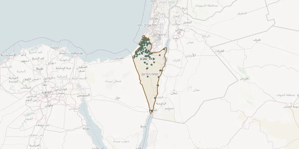 © OpenStreetMap
- Ein Gedi CemeteryGPS coordinates: 31.45288° N, 35.37967° E
- Ein HaBsor CemeteryGPS coordinates: 31.28563° N, 34.45093° E
- Ein HaShlosha CemeteryGPS coordinates: 31.35091° N, 34.40743° E
- Galon CemeteryGPS coordinates: 31.63575° N, 34.83768° E
- Gan Yavne New CemeteryGPS coordinates: 31.78231° N, 34.72487° E
- Gan Yavne Old CemeteryGPS coordinates: 31.79906° N, 34.71597° E
- Gat CemeteryGPS coordinates: 31.62476° N, 34.78746° E
- Ge'a CemeteryGPS coordinates: 31.62826° N, 34.61703° E
- Gevim CemeteryGPS coordinates: 31.50859° N, 34.60643° E
- Givat HaKalaniot CemeteryGPS coordinates: 31.50888° N, 34.62845° E
- Givati CemeteryGPS coordinates: 31.72575° N, 34.67587° E
- Gush Yakhdav CemeteryGPS coordinates: 31.37927° N, 34.63964° E
- Gvar'am CemeteryGPS coordinates: 31.59498° N, 34.59947° E
- Hora Muslim CemeteryGPS coordinates: 31.31026° N, 34.90802° E
- Idan CemeteryGPS coordinates: 30.80983° N, 35.27889° E
- Ir ovot CemeteryGPS coordinates: 30.80797° N, 35.24241° E
- Karmiya CemeteryGPS coordinates: 31.59915° N, 34.54731° E
- Ketura CemeteryGPS coordinates: 29.97130° N, 35.05594° E
- Kfar Akhim Regional CemeteryGPS coordinates: 31.73948° N, 34.76281° E
- Kfar Aza CemeteryGPS coordinates: 31.47749° N, 34.52731° E
- Kfar HaRif CemeteryGPS coordinates: 31.73932° N, 34.80719° E
- Kfar Maimon CemeteryGPS coordinates: 31.43823° N, 34.52450° E
- Kfar Menahem CemeteryGPS coordinates: 31.73079° N, 34.83234° E
- Kfar Warburg CemeteryGPS coordinates: 31.72389° N, 34.72533° E
- Khatserim CemeteryGPS coordinates: 31.23987° N, 34.72179° E
- Khatsor Ashdod CemeteryGPS coordinates: 31.77865° N, 34.72081° E
- Khirbit Zbalih CemeteryGPS coordinates: 31.41216° N, 34.74974° E
- Kibbutz Eilot CemeteryGPS coordinates: 29.58396° N, 34.95859° E
- Kibbutz Sde Boker CemeteryGPS coordinates: 30.88004° N, 34.79660° E
- Kiryat Gat CemeteryGPS coordinates: 31.60626° N, 34.78685° E