
Batken
53 known cemeteries in Batken, Kyrgyzstan.
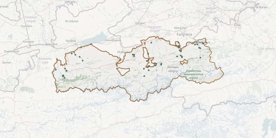 © OpenStreetMap
- Abdurahman Kyzy Fatila Ajy CemeteryGPS coordinates: 40.23941° N, 72.15827° E
- Andarak CemeteryGPS coordinates: 39.76683° N, 69.48275° E
- Andarak CemeteryGPS coordinates: 39.73995° N, 69.50106° E
- Andarak CemeteryGPS coordinates: 39.76015° N, 69.47086° E
- Andarak CemeteryGPS coordinates: 39.76410° N, 69.46545° E
- Andarkham CemeteryGPS coordinates: 39.99073° N, 69.84818° E
- Apken CemeteryGPS coordinates: 40.09245° N, 71.10029° E
- Aydarken Orthodox CemeteryGPS coordinates: 39.94461° N, 71.35017° E
- Ayderkon CemeteryGPS coordinates: 39.93012° N, 71.34777° E
- Batken Christian CemeteryGPS coordinates: 40.05774° N, 70.82800° E
- Batken City CemeteryGPS coordinates: 40.07793° N, 70.83127° E
- Bazar-Bashy CemeteryGPS coordinates: 40.07943° N, 70.80576° E
- Bel CemeteryGPS coordinates: 39.95363° N, 71.22954° E
- Boz-Adyr CemeteryGPS coordinates: 39.98552° N, 71.07375° E
- Chigdalik CemeteryGPS coordinates: 40.23137° N, 70.00753° E
- Chymken CemeteryGPS coordinates: 39.87516° N, 69.51322° E
- Eski-Oochu CemeteryGPS coordinates: 40.07665° N, 69.70756° E
- Gaz Ate CemeteryGPS coordinates: 39.87224° N, 71.01714° E
- Iskra CemeteryGPS coordinates: 39.77603° N, 69.47789° E
- Kabyrstan Molo CemeteryGPS coordinates: 39.92168° N, 71.24325° E
- Kabyrstar CemeteryGPS coordinates: 40.14158° N, 71.69794° E
- Kadamjay CemeteryGPS coordinates: 40.12520° N, 71.72663° E
- Kan CemeteryGPS coordinates: 39.76321° N, 71.02545° E
- Kara-Dobo CemeteryGPS coordinates: 40.22958° N, 72.03593° E
- Kara Tokay CemeteryGPS coordinates: 40.00081° N, 71.10738° E
- Karool CemeteryGPS coordinates: 40.03424° N, 72.09646° E
- Kelechek CemeteryGPS coordinates: 40.20561° N, 71.68398° E
- Kulundu CemeteryGPS coordinates: 40.09540° N, 69.63921° E
- Kurulush CemeteryGPS coordinates: 40.25512° N, 71.67642° E
- Kyshtut CemeteryGPS coordinates: 39.85024° N, 71.10981° E