
Jalal-Abad
42 known cemeteries in Jalal-Abad, Kyrgyzstan.
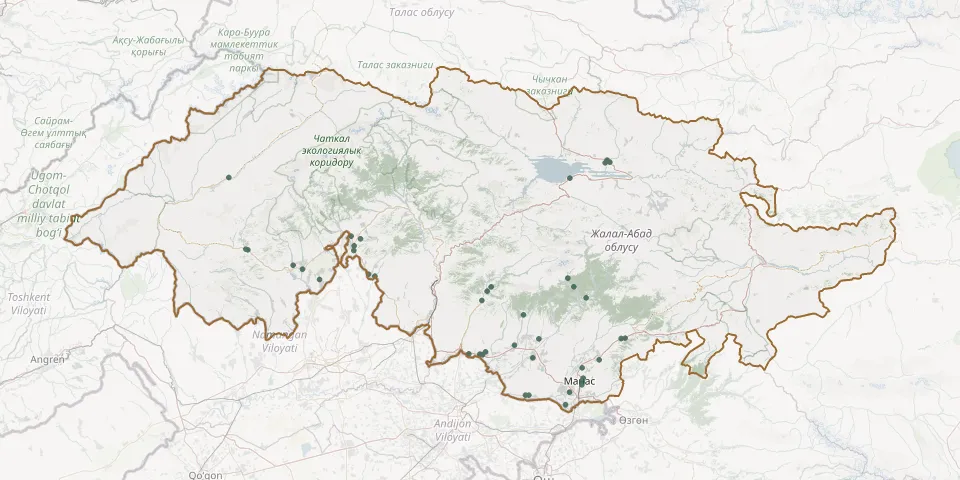 © OpenStreetMap
- 1-May CemeteryGPS coordinates: 41.10506° N, 72.77632° E
- Ak Dobo murzo zhayy CemeteryGPS coordinates: 41.52957° N, 71.74576° E
- Ak-Mechet'-Aral CemeteryGPS coordinates: 40.87230° N, 72.70441° E
- Ala-Buka CemeteryGPS coordinates: 41.39370° N, 71.47837° E
- Arslanbob CemeteryGPS coordinates: 41.35568° N, 72.93706° E
- Atana Muslim CemeteryGPS coordinates: 41.37315° N, 71.84232° E
- Boston CemeteryGPS coordinates: 41.04241° N, 72.45374° E
- Bubu Ene CemeteryGPS coordinates: 41.40912° N, 71.42791° E
- Buzuk CemeteryGPS coordinates: 41.47522° N, 71.16806° E
- Buzuk CemeteryGPS coordinates: 41.47333° N, 71.17874° E
- Chkalov Waterside CemeteryGPS coordinates: 41.76683° N, 72.94727° E
- Choko-Dobo CemeteryGPS coordinates: 40.91473° N, 73.01396° E
- Chong Kyrgyz CemeteryGPS coordinates: 40.87161° N, 72.72256° E
- Gulistan CemeteryGPS coordinates: 40.98545° N, 73.01578° E
- Jerge-Tal CemeteryGPS coordinates: 41.10840° N, 73.25179° E
- Kanış-Kıya CemeteryGPS coordinates: 41.77062° N, 71.07438° E
- Kazhar CemeteryGPS coordinates: 41.35126° N, 71.57223° E
- Kepryukbashi CemeteryGPS coordinates: 41.31992° N, 72.51462° E
- Kerben CemeteryGPS coordinates: 41.46981° N, 71.76175° E
- Kerben Old Muslim CemeteryGPS coordinates: 41.48908° N, 71.76201° E
- Koçkor-Ata Christian CemeteryGPS coordinates: 41.05133° N, 72.48343° E
- Komsomol'skiy CemeteryGPS coordinates: 41.02658° N, 72.74331° E
- Kuluk-Dobo Muslim CemeteryGPS coordinates: 41.51766° N, 71.79737° E
- Kurulush City CemeteryGPS coordinates: 41.03937° N, 72.46764° E
- Manas Christian CemeteryGPS coordinates: 40.92427° N, 73.01446° E
- Manas Christian City CemeteryGPS coordinates: 40.93424° N, 73.01664° E
- Masy CemeteryGPS coordinates: 41.07933° N, 72.64326° E
- Maylısuu City CemeteryGPS coordinates: 41.26420° N, 72.46417° E
- Oogon-Talaa CemeteryGPS coordinates: 41.27445° N, 73.03655° E
- Sary-Bee CemeteryGPS coordinates: 41.30270° N, 72.49310° E