
Talas
25 known cemeteries in Talas, Kyrgyzstan.
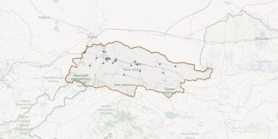 © OpenStreetMap
- Bala-Saruu Village CemeteryGPS coordinates: 42.69035° N, 71.62631° E
- Banay CemeteryGPS coordinates: 42.39610° N, 72.71905° E
- Beyit CemeteryGPS coordinates: 42.67642° N, 71.21530° E
- Birinchi May CemeteryGPS coordinates: 42.53530° N, 71.76232° E
- Boo-Terek CemeteryGPS coordinates: 42.56395° N, 71.82052° E
- Chong-Kapka CemeteryGPS coordinates: 42.69286° N, 71.58665° E
- Kamash CemeteryGPS coordinates: 42.58946° N, 71.70363° E
- Kara Buura CemeteryGPS coordinates: 42.60179° N, 71.63890° E
- Kara Buura CemeteryGPS coordinates: 42.58816° N, 71.63506° E
- Kara-Buura CemeteryGPS coordinates: 42.53289° N, 71.58655° E
- Kara-Mazar CemeteryGPS coordinates: 42.60335° N, 71.45772° E
- Kara-Say CemeteryGPS coordinates: 42.49629° N, 71.32814° E
- Kara-Suu CemeteryGPS coordinates: 42.60320° N, 71.66926° E
- Kara-Suu Village CemeteryGPS coordinates: 42.57142° N, 71.65659° E
- Klyuchevka CemeteryGPS coordinates: 42.59043° N, 71.82887° E
- Kopuro Bazar CemeteryGPS coordinates: 42.48958° N, 72.95428° E
- Kuru-Maymak CemeteryGPS coordinates: 42.68625° N, 71.24352° E
- Kyrgyzstan CemeteryGPS coordinates: 42.56170° N, 71.80233° E
- Mendikara Ata CemeteryGPS coordinates: 42.36996° N, 71.97937° E
- Murzo CemeteryGPS coordinates: 42.41900° N, 72.28134° E
- Murzo CemeteryGPS coordinates: 42.59465° N, 71.69383° E
- Russian cemetery in TalasGPS coordinates: 42.51190° N, 72.23025° E
- Sulpukor CemeteryGPS coordinates: 42.52002° N, 72.65729° E
- Talas Village CemeteryGPS coordinates: 42.55647° N, 72.18522° E
- Tuyto Murzosu CemeteryGPS coordinates: 42.50101° N, 72.11307° E