
Diekirch
146 known cemeteries in Diekirch, Luxembourg.
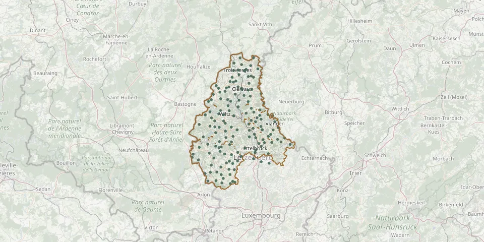 © OpenStreetMap
- Mecher CemeteryGPS coordinates: 49.92260° N, 5.87782° E
- Merkholtz CemeteryGPS coordinates: 49.96152° N, 5.98067° E
- Merscheid les Putscheid CemeteryGPS coordinates: 49.95440° N, 6.10777° E
- Mertzig CemeteryGPS coordinates: 49.83286° N, 6.00258° E
- Mëttscheed - Merscheid CemeteryGPS coordinates: 49.86946° N, 5.96868° E
- Michelau CemeteryGPS coordinates: 49.89581° N, 6.09391° E
- Michelbouch CemeteryGPS coordinates: 49.81859° N, 6.02017° E
- Moestroff CemeteryGPS coordinates: 49.86955° N, 6.23804° E
- Munshausen CemeteryGPS coordinates: 50.03230° N, 6.03719° E
- Nachtmanderscheid CemeteryGPS coordinates: 49.94865° N, 6.12918° E
- Nagem CemeteryGPS coordinates: 49.78776° N, 5.85823° E
- Neidhausen CemeteryGPS coordinates: 50.02936° N, 6.07050° E
- Nidderpallener CemeteryGPS coordinates: 49.75426° N, 5.91221° E
- Noerdange CemeteryGPS coordinates: 49.74080° N, 5.92357° E
- Noertrange CemeteryGPS coordinates: 49.97938° N, 5.90892° E
- Nordstad Woodland CemeteryGPS coordinates: 49.87760° N, 6.14035° E
- Noumer CemeteryGPS coordinates: 49.79447° N, 6.17322° E
- Oberpallen CemeteryGPS coordinates: 49.73136° N, 5.83976° E
- Oberwampach CemeteryGPS coordinates: 50.01730° N, 5.85810° E
- Ospern CemeteryGPS coordinates: 49.78049° N, 5.91062° E
- Pëntscher CemeteryGPS coordinates: 49.99220° N, 6.00540° E
- Perlé CemeteryGPS coordinates: 49.81563° N, 5.75449° E
- Réidener CemeteryGPS coordinates: 49.76327° N, 5.88824° E
- Reimberg Woodland CemeteryGPS coordinates: 49.80132° N, 5.95645° E
- Rindschleiden CemeteryGPS coordinates: 49.84936° N, 5.90015° E
- Rippweiler CemeteryGPS coordinates: 49.75444° N, 5.95987° E
- Rodershausen CemeteryGPS coordinates: 50.03892° N, 6.13013° E
- Rueder CemeteryGPS coordinates: 50.05349° N, 6.07901° E
- Rumlange CemeteryGPS coordinates: 50.07872° N, 5.97880° E
- Saeul CemeteryGPS coordinates: 49.72724° N, 5.98706° E