
Campeche
49 known cemeteries in Campeche, Mexico.
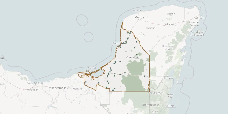 © OpenStreetMap
- Nunkiní North CemeteryGPS coordinates: 20.40459° N, 90.14275° W
- Nunkiní South CemeteryGPS coordinates: 20.39238° N, 90.15087° W
- Oxcabal Municipal CemeteryGPS coordinates: 18.86107° N, 90.96834° W
- Palizada CemeteryGPS coordinates: 18.25357° N, 92.09439° W
- Paraíso del SilencioGPS coordinates: 19.79664° N, 90.60659° W
- Pital Nuevo Municipal CemeteryGPS coordinates: 18.59462° N, 91.03272° W
- Plan de Ayala Municipal CemeteryGPS coordinates: 18.77918° N, 90.93506° W
- Pomuch CemeteryGPS coordinates: 20.13173° N, 90.17783° W
- Reforma Agraria CemeteryGPS coordinates: 19.05999° N, 90.78472° W
- Samulá CemeteryGPS coordinates: 19.82710° N, 90.55122° W
- San Isidro Municipal CemeteryGPS coordinates: 18.63321° N, 91.05284° W
- San Pablo Pixtún CemeteryGPS coordinates: 19.13511° N, 90.73617° W
- San Román CemeteryGPS coordinates: 19.83610° N, 90.55141° W
- Santa Lucía CemeteryGPS coordinates: 19.84867° N, 90.51205° W
- Seybaplaya New CemeteryGPS coordinates: 19.62933° N, 90.68129° W
- Tenabo Municipal CemeteryGPS coordinates: 20.03295° N, 90.23712° W
- Tinún CemeteryGPS coordinates: 19.96836° N, 90.22843° W
- Último Paseo CemeteryGPS coordinates: 18.64525° N, 91.84045° W
- Villa Madero Local Cemetery (The Last Abode)GPS coordinates: 19.52510° N, 90.70326° W