
Chiapas
83 known cemeteries in Chiapas, Mexico.
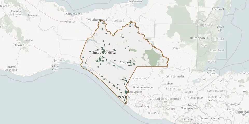 © OpenStreetMap
- Quistajito CemeteryGPS coordinates: 16.23861° N, 92.01522° W
- Rafael Pascasio Gamboa CemeteryGPS coordinates: 17.91709° N, 93.26545° W
- Raymundo Enríquez CemeteryGPS coordinates: 14.86081° N, 92.32429° W
- Rozendous Salazar Tolan Local CemeteryGPS coordinates: 16.45914° N, 94.00524° W
- San Cristóbal de las Casas Municipal CemeteryGPS coordinates: 16.72679° N, 92.65363° W
- San Fernando Municipal CemeteryGPS coordinates: 16.86541° N, 93.20751° W
- San Gregorio CemeteryGPS coordinates: 15.02434° N, 92.13976° W
- San Jerónimo Municipal CemeteryGPS coordinates: 15.03972° N, 92.13113° W
- San Raquel CemeteryGPS coordinates: 14.76558° N, 92.18121° W
- San Sebastian CemeteryGPS coordinates: 16.78282° N, 92.69233° W
- Soconusco CemeteryGPS coordinates: 15.32081° N, 92.73084° W
- Solosuchiapa Municipal CemeteryGPS coordinates: 17.42836° N, 93.02874° W
- St. Peter CemeteryGPS coordinates: 16.69742° N, 93.10316° W
- Tumbalá Municipal CemeteryGPS coordinates: 17.27794° N, 92.31300° W
- Tuxtla Gutiérrez Municipal CemeteryGPS coordinates: 16.74668° N, 93.10888° W
- Unión Juárez Municipal CemeteryGPS coordinates: 15.05974° N, 92.07876° W
- Unión Roja Ejido CemeteryGPS coordinates: 15.04328° N, 92.21782° W
- Úrsulo Galván CemeteryGPS coordinates: 16.28722° N, 93.41637° W
- Villa Comaltitlán Municipal CemeteryGPS coordinates: 15.20803° N, 92.56594° W
- Villa Corzo Ejido CemeteryGPS coordinates: 16.06621° N, 93.37094° W
- Villacorzo Municipal CemeteryGPS coordinates: 16.18281° N, 93.26272° W
- Villa Hidalgo Ejido CemeteryGPS coordinates: 16.31232° N, 93.15532° W
- Viva Cardenas CemeteryGPS coordinates: 16.82842° N, 93.19409° W