
Chihuahua
54 known cemeteries in Chihuahua, Mexico.
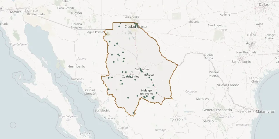 © OpenStreetMap
- Mesa de San Rafael Sectional CemeteryGPS coordinates: 25.78677° N, 106.65821° W
- Morelos Municipal CemeteryGPS coordinates: 29.63973° N, 107.72175° W
- Moris Municipal CemeteryGPS coordinates: 28.15807° N, 108.52726° W
- Nuevo Casas Grandes CemeteryGPS coordinates: 30.41292° N, 107.89209° W
- Nuevo Madera Municipal CemeteryGPS coordinates: 29.21451° N, 108.13900° W
- Ojo Frío CemeteryGPS coordinates: 30.55873° N, 108.45525° W
- Palomas de Villa Municipal CemeteryGPS coordinates: 31.76371° N, 107.62751° W
- Recinto de La Oración Cemetery, Ciudad JuárezGPS coordinates: 31.72528° N, 106.38833° W
- San Buenaventura Municipal CemeteryGPS coordinates: 29.84442° N, 107.44619° W
- San Diego Municipal CemeteryGPS coordinates: 26.82560° N, 105.79779° W
- San Francisco del Oro Municipal CemeteryGPS coordinates: 26.87538° N, 105.84667° W
- San Isidro Huajumar Municipal CemeteryGPS coordinates: 28.18901° N, 108.27206° W
- San Jorge Municipal Cemetery No. 4GPS coordinates: 28.56402° N, 106.01039° W
- San Juanito CemeteryGPS coordinates: 27.97336° N, 107.60730° W
- San Rafael Municipal CemeteryGPS coordinates: 29.25676° N, 107.41535° W
- San Rafael Municipal CemeteryGPS coordinates: 31.52081° N, 106.49536° W
- Santa Rita CemeteryGPS coordinates: 28.22572° N, 106.87433° W
- Santa Rosalía De Camargo Municipal CemeteryGPS coordinates: 27.66546° N, 105.15523° W
- Saucillo Municipal CemeteryGPS coordinates: 28.03521° N, 105.29892° W
- Sauzal CemeteryGPS coordinates: 31.58282° N, 106.33077° W
- Sisoguichi Sectional CemeteryGPS coordinates: 27.76831° N, 107.48813° W
- Sueños Eternos CemeteryGPS coordinates: 31.64602° N, 106.41452° W
- Tutuaca CemeteryGPS coordinates: 28.03448° N, 106.52269° W
- Vicente Guerrero CemeteryGPS coordinates: 28.54899° N, 107.47304° W