
Oaxaca
103 known cemeteries in Oaxaca, Mexico.
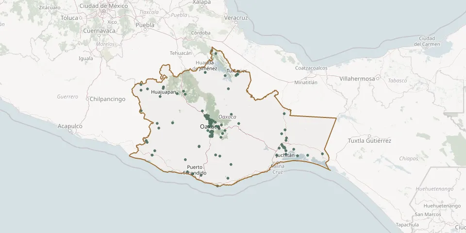 © OpenStreetMap
- 16 de Septiembre Municipal CemeteryGPS coordinates: 17.80983° N, 97.78256° W
- Acatlán Municipal CemeteryGPS coordinates: 18.53261° N, 96.60037° W
- Alemán Municipal Cemetery, San Andrés ZautlaGPS coordinates: 17.19488° N, 96.84411° W
- Asunción Ixtaltepec CemeteryGPS coordinates: 16.50822° N, 95.04474° W
- Asunción Ixtaltepec CemeteryGPS coordinates: 16.50406° N, 95.06524° W
- Asunción Ocotlán Municipal CemeteryGPS coordinates: 16.75789° N, 96.72186° W
- Bajos de Chila CemeteryGPS coordinates: 15.92707° N, 97.12227° W
- Chalcatongo CemeteryGPS coordinates: 17.03445° N, 97.57623° W
- Chinigue CemeteryGPS coordinates: 16.53039° N, 96.97698° W
- Chivela CemeteryGPS coordinates: 16.70957° N, 94.99986° W
- Cosolapa Municipal CemeteryGPS coordinates: 18.59067° N, 96.69156° W
- Dolores Cemetery, San Blas AtempaGPS coordinates: 16.32981° N, 95.21935° W
- Domingo de Ramos Municipal CemeteryGPS coordinates: 16.43404° N, 95.01128° W
- Donají Municipal CemeteryGPS coordinates: 17.23493° N, 95.04824° W
- El Barrio de la Soledad Municipal CemeteryGPS coordinates: 16.80236° N, 95.10720° W
- El Espinal Municipal CemeteryGPS coordinates: 16.48748° N, 95.03694° W
- El Marquesado CemeteryGPS coordinates: 17.07563° N, 96.73909° W
- El Mogote Hamlet Garden CemeteryGPS coordinates: 17.09362° N, 96.68613° W
- El Refugio Cemetery, Santo Domingo TehuantepecGPS coordinates: 16.33350° N, 95.22046° W
- Hidalgo Cemetery, Guadalupe EtlaGPS coordinates: 17.17044° N, 96.80602° W
- Huautla de Jiménez Large CemeteryGPS coordinates: 18.12611° N, 96.83851° W
- Jardín de los Sueños CemeteryGPS coordinates: 18.08234° N, 96.11398° W
- Kampesante Municipal CemeteryGPS coordinates: 17.02276° N, 96.08020° W
- La Estancia CemeteryGPS coordinates: 17.65433° N, 97.29075° W
- La Gran Lucha CemeteryGPS coordinates: 17.77315° N, 96.31184° W
- Mazunte CemeteryGPS coordinates: 15.66473° N, 96.55715° W
- Miahuatlán Municipal Cemetery, 2nd SectionGPS coordinates: 16.34295° N, 96.60158° W
- New Awakening CemeteryGPS coordinates: 18.05887° N, 96.14173° W
- Nizanda Municipal CemeteryGPS coordinates: 16.65847° N, 95.00950° W
- Ocotlán de Morelos Municipal CemeteryGPS coordinates: 16.79199° N, 96.68069° W