
Quintana Roo
28 known cemeteries in Quintana Roo, Mexico.
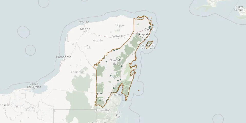 © OpenStreetMap
- Alvarous Obregon Main Cemetery near PuctéGPS coordinates: 18.29669° N, 88.62654° W
- Antorcha Bacalar CemeteryGPS coordinates: 18.68732° N, 88.41073° W
- Calderitas Municipal CemeteryGPS coordinates: 18.55669° N, 88.25617° W
- Chetumal Civil Municipal CemeteryGPS coordinates: 18.50258° N, 88.30373° W
- Cocoyol CemeteryGPS coordinates: 18.16718° N, 88.69646° W
- Diege Main CemeteryGPS coordinates: 19.90150° N, 88.81325° W
- Eternal Rest CemeteryGPS coordinates: 18.67681° N, 88.39483° W
- Felipe Carrillo Puerto New CemeteryGPS coordinates: 19.56963° N, 88.06110° W
- John Sarabia CemeteryGPS coordinates: 18.49590° N, 88.48214° W
- La Gloria Municipal Cemetery, Isla MujeresGPS coordinates: 21.22211° N, 86.72326° W
- Lázaro Cárdenas CemeteryGPS coordinates: 18.98056° N, 88.21630° W
- Limones Ejido CemeteryGPS coordinates: 19.02846° N, 88.11079° W
- Los Álamos Municipal CemeteryGPS coordinates: 21.16722° N, 86.84225° W
- Los Olivos Municipal Cemetery, CancúnGPS coordinates: 21.14243° N, 86.88070° W
- Mahogany Municipal CemeteryGPS coordinates: 18.44508° N, 89.10632° W
- Main CemeteryGPS coordinates: 19.75341° N, 88.71508° W
- Mi Última Morada CemeteryGPS coordinates: 21.08933° N, 86.85392° W
- Nicolás Bravo Cemetery (Laguna Om)GPS coordinates: 18.45854° N, 88.94126° W
- Philip Carrillous Port CemeteryGPS coordinates: 19.57194° N, 88.05032° W
- Playa del Carmen Municipal CemeteryGPS coordinates: 20.65034° N, 87.06491° W
- Pucté CemeteryGPS coordinates: 18.22018° N, 88.66813° W
- San Miguel Municipal CemeteryGPS coordinates: 20.50399° N, 86.95483° W
- Señor Local CemeteryGPS coordinates: 19.84435° N, 88.13911° W
- Subteniente López CemeteryGPS coordinates: 18.49642° N, 88.39752° W
- Tepich Q. Roo General CemeteryGPS coordinates: 20.23902° N, 88.26434° W
- Tihosuco CemeteryGPS coordinates: 20.19875° N, 88.38288° W
- Tres Garantías CemeteryGPS coordinates: 18.19151° N, 88.98897° W
- Valle Hermoso CemeteryGPS coordinates: 19.18455° N, 88.52768° W