
Sonora
159 known cemeteries in Sonora, Mexico.
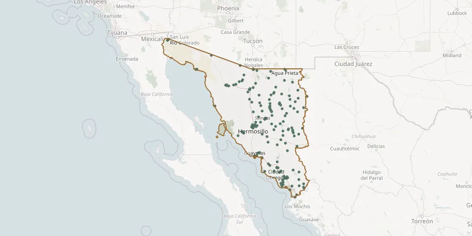 © OpenStreetMap
- Mesa del Campanero CemeteryGPS coordinates: 28.33362° N, 109.00767° W
- Mesa del Seri CemeteryGPS coordinates: 29.10579° N, 110.83969° W
- Mineros de Pilares CemeteryGPS coordinates: 28.75639° N, 111.64087° W
- Moctezuma Municipal CemeteryGPS coordinates: 29.80142° N, 109.67268° W
- Monsignor Porfirio Cornídez Cemetery No. 1GPS coordinates: 29.06447° N, 109.24350° W
- Movas CemeteryGPS coordinates: 28.16554° N, 109.44010° W
- Nácori Chico CemeteryGPS coordinates: 29.68400° N, 108.98331° W
- Nacozari de García Municipal CemeteryGPS coordinates: 30.37441° N, 109.69595° W
- Natora CemeteryGPS coordinates: 29.04608° N, 108.76417° W
- Navojoa New CemeteryGPS coordinates: 27.09349° N, 109.42023° W
- Obregón Municipal CemeteryGPS coordinates: 31.85188° N, 112.83349° W
- Ojo de Agua CemeteryGPS coordinates: 30.03391° N, 109.78765° W
- Onavas Municipal CemeteryGPS coordinates: 28.45977° N, 109.52658° W
- Opodepe Municipal CemeteryGPS coordinates: 29.92586° N, 110.62589° W
- Oquitoa Municipal CemeteryGPS coordinates: 30.74343° N, 111.73504° W
- Palo Verde Cemetery, HermosilloGPS coordinates: 29.04921° N, 110.97455° W
- Pitiquito Municipal CemeteryGPS coordinates: 30.68202° N, 112.06093° W
- Pueblo de Álamos CemeteryGPS coordinates: 29.20976° N, 110.13843° W
- Pueblo Viejo CemeteryGPS coordinates: 30.69224° N, 112.14941° W
- Pueblo Yaqui Municipal CemeteryGPS coordinates: 27.35964° N, 110.03051° W
- Puerto Libertad CemeteryGPS coordinates: 29.90738° N, 112.67250° W
- Puerto Peñasco Cemetery No. 1GPS coordinates: 31.31805° N, 113.53049° W
- Puerto Peñasco Cemetery No. 2GPS coordinates: 31.32233° N, 113.50849° W
- Querobabi Old CemeteryGPS coordinates: 30.05682° N, 111.02462° W
- Rayón CemeteryGPS coordinates: 29.71405° N, 110.56800° W
- Reforma Centro CemeteryGPS coordinates: 31.32872° N, 110.96072° W
- Rural CemeteryGPS coordinates: 30.71260° N, 112.20109° W
- Sahuaro Municipal CemeteryGPS coordinates: 29.11523° N, 111.02684° W
- San Bartolo CemeteryGPS coordinates: 29.14599° N, 110.79047° W
- San Felipe de Jesús Municipal CemeteryGPS coordinates: 29.86241° N, 110.24003° W