
Yucatán
116 known cemeteries in Yucatán, Mexico.
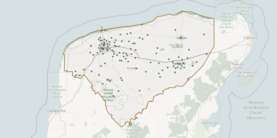 © OpenStreetMap
- El Bolón Municipal CemeteryGPS coordinates: 20.84439° N, 89.83441° W
- Euán CemeteryGPS coordinates: 20.99702° N, 89.34760° W
- General de Umán CemeteryGPS coordinates: 20.88175° N, 89.75516° W
- Halachó Cemetery IGPS coordinates: 20.47792° N, 90.09047° W
- Hocabá CemeteryGPS coordinates: 20.81601° N, 89.25465° W
- Hoctún CemeteryGPS coordinates: 20.86490° N, 89.21000° W
- Holactun CemeteryGPS coordinates: 20.88144° N, 89.33547° W
- Homún General CemeteryGPS coordinates: 20.74053° N, 89.29651° W
- Huhi Municipal CemeteryGPS coordinates: 20.72291° N, 89.17119° W
- Hunucmá Municipal CemeteryGPS coordinates: 21.00345° N, 89.87958° W
- Itzincab CemeteryGPS coordinates: 20.91147° N, 89.69800° W
- Ixil Municipal CemeteryGPS coordinates: 21.14817° N, 89.48944° W
- Izamal Municipal CemeteryGPS coordinates: 20.92836° N, 89.02973° W
- Jardín de la Paz General CemeteryGPS coordinates: 21.15762° N, 88.17418° W
- Jardines del Recuerdo CemeteryGPS coordinates: 20.94240° N, 89.65010° W
- Jardines de Paz CemeteryGPS coordinates: 20.95176° N, 89.64152° W
- Kanasín Cemetery No. 2GPS coordinates: 20.92367° N, 89.56833° W
- Kanasín General CemeteryGPS coordinates: 20.93757° N, 89.56221° W
- Kancab Municipal CemeteryGPS coordinates: 20.19684° N, 89.35342° W
- Kantunil Municipal CemeteryGPS coordinates: 20.79087° N, 89.03419° W
- Kanxoc CemeteryGPS coordinates: 20.61948° N, 88.10430° W
- Kaua CemeteryGPS coordinates: 20.61939° N, 88.42030° W
- Komchén Municipal CemeteryGPS coordinates: 21.10130° N, 89.66779° W
- Maxcanu Municipal CemeteryGPS coordinates: 20.58058° N, 90.01363° W
- Merida General CemeteryGPS coordinates: 20.94993° N, 89.64022° W
- Motul CemeteryGPS coordinates: 21.08815° N, 89.29069° W
- Muna Municipal CemeteryGPS coordinates: 20.48711° N, 89.72636° W
- Nahbalam Municipal CemeteryGPS coordinates: 20.93694° N, 88.01362° W
- Nolo CemeteryGPS coordinates: 21.01142° N, 89.42830° W
- Opichén Municipal CemeteryGPS coordinates: 20.55177° N, 89.86553° W