
Limburg
333 known cemeteries in Limburg, Netherlands.
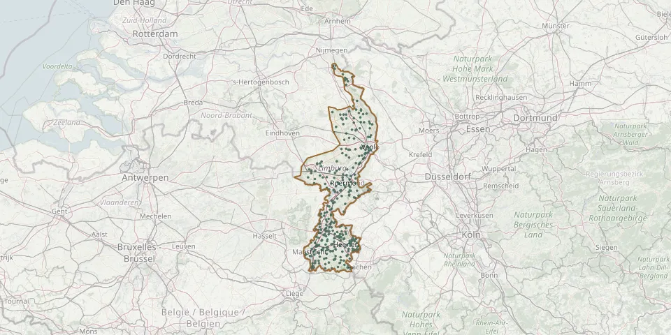 © OpenStreetMap
- Stein Monastery ChurchyardGPS coordinates: 50.96121° N, 5.75629° E
- Stevensweert General CemeteryGPS coordinates: 51.13237° N, 5.84397° E
- St. Gertrudiskerk ChurchyardGPS coordinates: 50.79530° N, 5.76370° E
- St. Jan CemeteryGPS coordinates: 50.92160° N, 5.92420° E
- St. Lambert Churchyard, BlerickGPS coordinates: 51.37269° N, 6.14360° E
- St. Lambert Churchyard, NederweertGPS coordinates: 51.28620° N, 5.74890° E
- St. Liduinakerk Roman Catholic CemeteryGPS coordinates: 51.22150° N, 5.82430° E
- St. Ludwig ChurchyardGPS coordinates: 51.15612° N, 6.14997° E
- St. Martin Churchyard, WeertGPS coordinates: 51.25517° N, 5.70158° E
- St. Martin Vijlenberg Cemetery, VijlenGPS coordinates: 50.78770° N, 5.96310° E
- St. Michael Monastery Cemetery, SteylGPS coordinates: 51.33631° N, 6.12260° E
- Stramproy CemeteryGPS coordinates: 51.19140° N, 5.72600° E
- St Remigiusparochie Roman Catholic CemeteryGPS coordinates: 50.83290° N, 5.98290° E
- Swalmen Roman Catholic CemeteryGPS coordinates: 51.23440° N, 6.04440° E
- Swartbroek ChurchyardGPS coordinates: 51.22982° N, 5.77138° E
- Sweikhuizen CemeteryGPS coordinates: 50.95410° N, 5.84420° E
- Swolgen Roman Catholic CemeteryGPS coordinates: 51.49190° N, 6.11670° E
- Tegelen CemeteryGPS coordinates: 51.34254° N, 6.14690° E
- Ter Borgh CemeteryGPS coordinates: 51.11970° N, 6.05000° E
- Terwinselen CemeteryGPS coordinates: 50.86845° N, 6.02770° E
- Thorn General CemeteryGPS coordinates: 51.16066° N, 5.83459° E
- Tienray Seven Sorrows ChurchyardGPS coordinates: 51.49290° N, 6.09170° E
- Treebeek Sint-Barbara ChurchyardGPS coordinates: 50.93691° N, 5.95121° E
- Tungelroij Roman Catholic ChurchyardGPS coordinates: 51.21264° N, 5.73092° E
- Tussen de Bergen CemeteryGPS coordinates: 51.17221° N, 6.00679° E
- Uilenpad ChurchyardGPS coordinates: 50.92470° N, 6.03020° E
- Ulestraten General CemeteryGPS coordinates: 50.90778° N, 5.78404° E
- Ulestraten Landscape CemeteryGPS coordinates: 50.91110° N, 5.78656° E
- Urmond Protestant CemeteryGPS coordinates: 50.99096° N, 5.76485° E
- UrsulinenhofGPS coordinates: 50.86330° N, 6.07220° E