
Limburg
333 known cemeteries in Limburg, Netherlands.
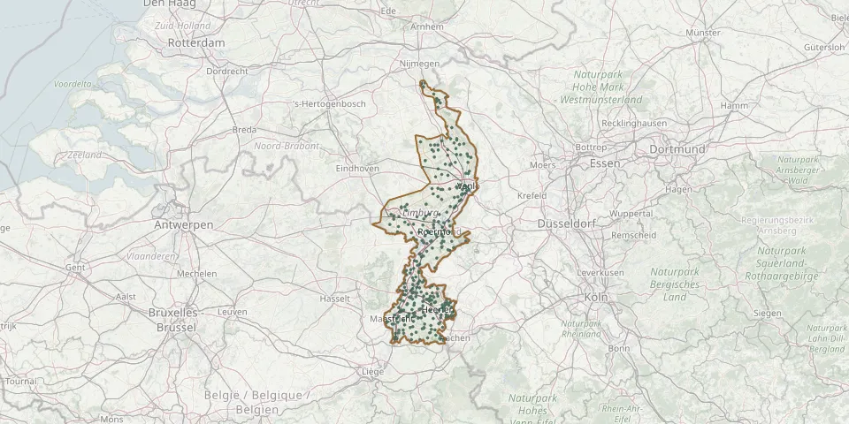 © OpenStreetMap
- Banholt General CemeteryGPS coordinates: 50.79080° N, 5.81320° E
- Beegden, KerkstraatGPS coordinates: 51.18820° N, 5.92090° E
- Beegden SenserhoveGPS coordinates: 51.19650° N, 5.91070° E
- Beek Jewish cemeteryGPS coordinates: 50.93447° N, 5.80589° E
- Beesel Roman Catholic CemeteryGPS coordinates: 51.26885° N, 6.03215° E
- Belfeld CemeteryGPS coordinates: 51.31699° N, 6.12200° E
- Belfeld CemeteryGPS coordinates: 51.31260° N, 6.10976° E
- Bemelen ChurchyardGPS coordinates: 50.84720° N, 5.76410° E
- Berg aan de Maas ChurchyardGPS coordinates: 51.00450° N, 5.76980° E
- Bergen General CemeteryGPS coordinates: 51.59668° N, 6.06229° E
- Berg en Terblijt Cemetery (Langen Akker)GPS coordinates: 50.86160° N, 5.79420° E
- Berg en Terblijt ChurchyardGPS coordinates: 50.86130° N, 5.78350° E
- Bergerbos Nature CemeteryGPS coordinates: 51.13141° N, 5.99980° E
- Bergerkamp CemeteryGPS coordinates: 51.15570° N, 5.93010° E
- Beringe CemeteryGPS coordinates: 51.33965° N, 5.94769° E
- Bingelrade CemeteryGPS coordinates: 50.97590° N, 5.92660° E
- Bleijerheide CemeteryGPS coordinates: 50.85182° N, 6.06247° E
- Blitterswijck CemeteryGPS coordinates: 51.53159° N, 6.11048° E
- Boekend CemeteryGPS coordinates: 51.37500° N, 6.11288° E
- Born CemeteryGPS coordinates: 51.03090° N, 5.80490° E
- Boschhuizen CemeteryGPS coordinates: 51.54541° N, 5.99992° E
- Boshoven CemeteryGPS coordinates: 51.26000° N, 5.68570° E
- Boukoul CemeteryGPS coordinates: 51.21478° N, 6.05158° E
- Brachterbeek Roman Catholic CemeteryGPS coordinates: 51.14559° N, 5.90873° E
- Broekheim CemeteryGPS coordinates: 50.87310° N, 5.82450° E
- Broekhuizen CemeteryGPS coordinates: 51.48582° N, 6.16393° E
- Broekhuizenvorst CemeteryGPS coordinates: 51.49503° N, 6.15746° E
- Broeksittard ChurchyardGPS coordinates: 51.00200° N, 5.89090° E
- Brummenberg CemeteryGPS coordinates: 51.17330° N, 5.96970° E
- Brunssum War CemeteryGPS coordinates: 50.95175° N, 5.97017° E