
North Holland
320 known cemeteries in North Holland, Netherlands.
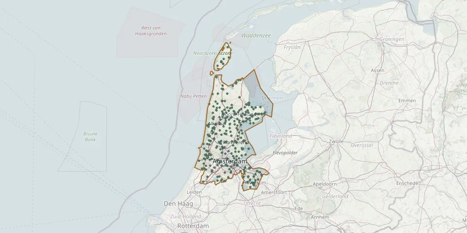 © OpenStreetMap
- Hensbroek CemeteryGPS coordinates: 52.65851° N, 4.88210° E
- HerdenkingsbosGPS coordinates: 52.34182° N, 4.66794° E
- Hilversum Jewish CemeteryGPS coordinates: 52.21992° N, 5.15121° E
- Hilversum North CemeteryGPS coordinates: 52.23958° N, 5.18008° E
- Hippolytushoef CemeteryGPS coordinates: 52.90681° N, 4.96012° E
- Hippolytushoef Zandburen General CemeteryGPS coordinates: 52.91447° N, 4.96408° E
- Hobrede General CemeteryGPS coordinates: 52.54662° N, 4.97866° E
- Hoge Berg Texel Cemetery of HonourGPS coordinates: 53.04039° N, 4.81361° E
- Holysloot CemeteryGPS coordinates: 52.41297° N, 5.02468° E
- Hoofddorp Iepenhof CemeteryGPS coordinates: 52.30179° N, 4.68779° E
- Hooge Vennen Cemetery, HeilooGPS coordinates: 52.59550° N, 4.71450° E
- Hoogkarspel General CemeteryGPS coordinates: 52.69574° N, 5.17809° E
- Hoogwoud ChurchyardGPS coordinates: 52.71710° N, 4.93500° E
- Hornhof CemeteryGPS coordinates: 52.26056° N, 5.04115° E
- Houtrijk en Polanen CemeteryGPS coordinates: 52.37697° N, 4.74531° E
- Huizen Old CemeteryGPS coordinates: 52.29646° N, 5.23139° E
- IJmuiden West CemeteryGPS coordinates: 52.45952° N, 4.60145° E
- Ilpendam CemeteryGPS coordinates: 52.46310° N, 4.95210° E
- Ilpendam Roman Catholic Church CemeteryGPS coordinates: 52.45955° N, 4.95264° E
- Isaac Hartman en vrouwGPS coordinates: 52.37017° N, 4.89991° E
- Jacobushof Roman Catholic CemeteryGPS coordinates: 52.56229° N, 4.73663° E
- Jewish Cemetery AmsterdamsevaartGPS coordinates: 52.38190° N, 4.66640° E
- Jisp CemeteryGPS coordinates: 52.50680° N, 4.85428° E
- Karssenhof Cemetery, Ouderkerk aan de AmstelGPS coordinates: 52.30248° N, 4.90406° E
- Keern General CemeteryGPS coordinates: 52.64618° N, 5.04750° E
- Kerkbuurt West CemeteryGPS coordinates: 52.74133° N, 5.18220° E
- Kleverlaan CemeteryGPS coordinates: 52.39629° N, 4.64008° E
- KloosterdijkGPS coordinates: 52.46292° N, 5.02712° E
- Koog aan de Zaan ChurchyardGPS coordinates: 52.46280° N, 4.81000° E
- Koogerkerk ChurchyardGPS coordinates: 52.69418° N, 4.81404° E