
North Holland
320 known cemeteries in North Holland, Netherlands.
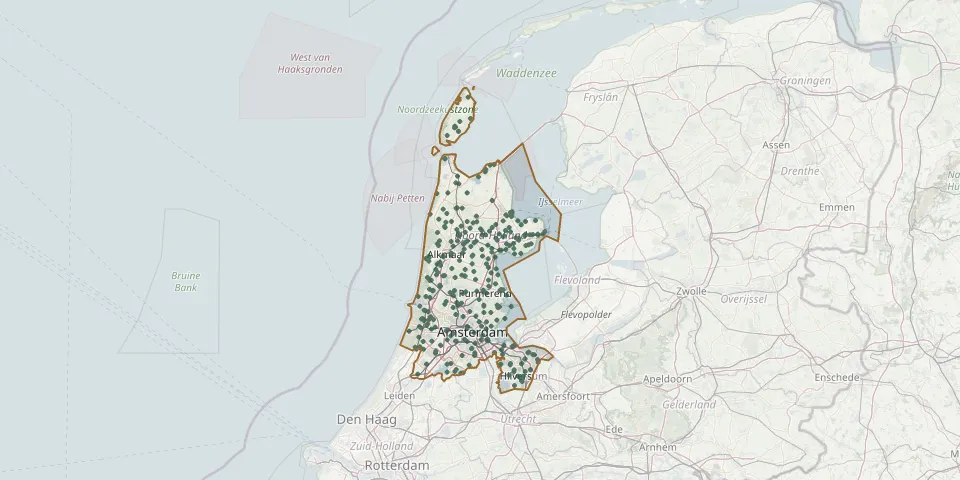 © OpenStreetMap
- Overtuin Roman Catholic CemeteryGPS coordinates: 52.56180° N, 4.73754° E
- Overveen Jewish CemeteryGPS coordinates: 52.39147° N, 4.59947° E
- Overveen Roman Catholic CemeteryGPS coordinates: 52.38730° N, 4.60760° E
- Parish Churchyard St John the BaptistGPS coordinates: 52.69789° N, 4.81192° E
- Parochiehof H Johan. de DoperGPS coordinates: 52.30870° N, 4.69020° E
- Petten General CemeteryGPS coordinates: 52.76656° N, 4.65780° E
- Protestants Kerk LimmenGPS coordinates: 52.56430° N, 4.69360° E
- Provinciaal Ziekenhuis Santpoort Jewish CemeteryGPS coordinates: 52.41811° N, 4.61604° E
- Purmerend Old CemeteryGPS coordinates: 52.50690° N, 4.95000° E
- Purmerend Overweersepolderdijk ChurchyardGPS coordinates: 52.51298° N, 4.94918° E
- Purmerlanderkerk CemeteryGPS coordinates: 52.48118° N, 4.92655° E
- Ransdorp General CemeteryGPS coordinates: 52.39290° N, 4.99386° E
- RC Cemetery Sint JozefGPS coordinates: 52.42324° N, 4.66127° E
- Rijp CemeteryGPS coordinates: 52.55920° N, 4.84970° E
- Rinnegom Roman Catholic CemeteryGPS coordinates: 52.60946° N, 4.65109° E
- Ruïnekerk CemeteryGPS coordinates: 52.71985° N, 4.87822° E
- Rust en vredeGPS coordinates: 52.78685° N, 4.80666° E
- Rustoord General CemeteryGPS coordinates: 52.69701° N, 5.21868° E
- Santpoort-Zuid CemeteryGPS coordinates: 52.41580° N, 4.61089° E
- Schagen Roman Catholic CemeteryGPS coordinates: 52.78661° N, 4.80189° E
- Scharwoude General CemeteryGPS coordinates: 52.62304° N, 5.01483° E
- Schellingwoude ChurchyardGPS coordinates: 52.38365° N, 4.96549° E
- Schellinkhout CemeteryGPS coordinates: 52.63471° N, 5.12083° E
- Schermerhorn Dutch Reformed ChurchyardGPS coordinates: 52.60130° N, 4.88950° E
- Schoorl General CemeteryGPS coordinates: 52.70564° N, 4.69818° E
- 's-Graveland Berestein General CemeteryGPS coordinates: 52.22481° N, 5.13922° E
- Sijbekarspel CemeteryGPS coordinates: 52.70953° N, 4.98422° E
- Sijpekerk Cemetery, Nieuw-LoosdrechtGPS coordinates: 52.19280° N, 5.12120° E
- Sint Maarten General CemeteryGPS coordinates: 52.76880° N, 4.75010° E
- Sint Maartensbrug General CemeteryGPS coordinates: 52.78260° N, 4.72940° E