
Overijssel
245 known cemeteries in Overijssel, Netherlands.
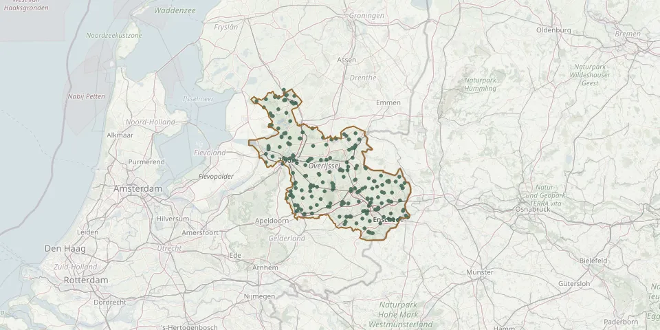 © OpenStreetMap
- Bergentheim General CemeteryGPS coordinates: 52.52124° N, 6.60554° E
- Berkum-Bruggenhoek Chinese CemeteryGPS coordinates: 52.52910° N, 6.13257° E
- Beth Chaïm Jewish CemeteryGPS coordinates: 52.51750° N, 6.26796° E
- Blankenham ChurchyardGPS coordinates: 52.76580° N, 5.89750° E
- Blokhuishof CemeteryGPS coordinates: 52.62558° N, 6.03834° E
- Blokzijl General CemeteryGPS coordinates: 52.72553° N, 5.96264° E
- Blokzijl Jewish CemeteryGPS coordinates: 52.72526° N, 5.96236° E
- Blokzijl New General CemeteryGPS coordinates: 52.72441° N, 5.97010° E
- Boerhaar Roman Catholic CemeteryGPS coordinates: 52.37474° N, 6.15206° E
- Borne General cemeteryGPS coordinates: 52.30374° N, 6.75259° E
- Borne Jewish CemeteryGPS coordinates: 52.29925° N, 6.74622° E
- Borne Old General CemeteryGPS coordinates: 52.28688° N, 6.73610° E
- Bornerbroek Roman Catholic ChurchyardGPS coordinates: 52.30878° N, 6.65575° E
- Bornsestraat General CemeteryGPS coordinates: 52.26908° N, 6.78978° E
- Boskamp Roman Catholic CemeteryGPS coordinates: 52.33186° N, 6.12991° E
- Bovenbroek CemeteryGPS coordinates: 52.54041° N, 5.91383° E
- Broekland Roman Catholic CemeteryGPS coordinates: 52.36332° N, 6.20024° E
- Bruchterweg cemeteryGPS coordinates: 52.56918° N, 6.62099° E
- Bruinehaar Municipal CemeteryGPS coordinates: 52.47600° N, 6.70640° E
- Daarle Private CemeteryGPS coordinates: 52.42960° N, 6.53423° E
- Dalfsen CemeteryGPS coordinates: 52.48557° N, 6.23004° E
- De Belte Roman Catholic ChurchyardGPS coordinates: 52.63688° N, 6.53868° E
- Dedemsvaart Achterveld CemeteryGPS coordinates: 52.61465° N, 6.47403° E
- De Dompe Cemetery, KampenGPS coordinates: 52.49895° N, 5.91479° E
- De Esch Roman Catholic CemeteryGPS coordinates: 52.40745° N, 6.77638° E
- De Espoort Cemetery, EnschedeGPS coordinates: 52.21925° N, 6.90421° E
- De Greente CemeteryGPS coordinates: 52.62203° N, 6.03866° E
- De Krim CemeteryGPS coordinates: 52.64030° N, 6.63010° E
- De Larikshof CemeteryGPS coordinates: 52.56109° N, 6.57860° E
- Delden Jewish CemeteryGPS coordinates: 52.24885° N, 6.71977° E