
Chiriquí
31 known cemeteries in Chiriquí, Panama.
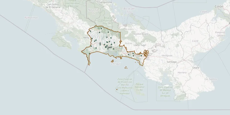 © OpenStreetMap
- Aguacatal CemeteryGPS coordinates: 8.46305° N, 82.46791° W
- Bágala CemeteryGPS coordinates: 8.48861° N, 82.52721° W
- Barú CemeteryGPS coordinates: 8.28583° N, 82.86575° W
- Boquete CemeteryGPS coordinates: 8.77156° N, 82.43528° W
- Breñón CemeteryGPS coordinates: 8.62412° N, 82.80939° W
- Bugaba CemeteryGPS coordinates: 8.48572° N, 82.62223° W
- Caldera CemeteryGPS coordinates: 8.64130° N, 82.37496° W
- Cerro Punta Public CemeteryGPS coordinates: 8.85277° N, 82.59432° W
- Chiriquí CemeteryGPS coordinates: 8.39030° N, 82.31697° W
- David Municipal CemeteryGPS coordinates: 8.41985° N, 82.41737° W
- De Cochea Abajo CemeteryGPS coordinates: 8.49418° N, 82.36214° W
- Divalá CemeteryGPS coordinates: 8.41103° N, 82.71678° W
- Dolega Municipal CemeteryGPS coordinates: 8.55723° N, 82.41145° W
- Gómez CemeteryGPS coordinates: 8.56619° N, 82.75014° W
- Guacá CemeteryGPS coordinates: 8.54666° N, 82.47067° W
- Gualaca Municipal CemeteryGPS coordinates: 8.52978° N, 82.29666° W
- Jardín de PazGPS coordinates: 8.52202° N, 82.62439° W
- Las Acacías Park Cemetery, DavidGPS coordinates: 8.44036° N, 82.49648° W
- Las Lajas CemeteryGPS coordinates: 8.23462° N, 81.86154° W
- Las Lomas CemeteryGPS coordinates: 8.42147° N, 82.37598° W
- Los Guayacanes Municipal CemeteryGPS coordinates: 8.39314° N, 82.44530° W
- Monte Lirio CemeteryGPS coordinates: 8.79320° N, 82.84422° W
- Potrerillos Arriba CemeteryGPS coordinates: 8.65640° N, 82.47122° W
- Progreso CemeteryGPS coordinates: 8.45258° N, 82.83097° W
- San Andrés CemeteryGPS coordinates: 8.58894° N, 82.72059° W
- San Félix District CemeteryGPS coordinates: 8.28868° N, 81.86905° W
- San Juan Cemetery, PueblitoGPS coordinates: 8.26516° N, 81.97223° W
- San Pablo Nuevo Communal CemeteryGPS coordinates: 8.42562° N, 82.49703° W
- Tinajas CemeteryGPS coordinates: 8.54183° N, 82.45474° W
- Tolé CemeteryGPS coordinates: 8.23767° N, 81.68003° W