
Coclé
39 known cemeteries in Coclé, Panama.
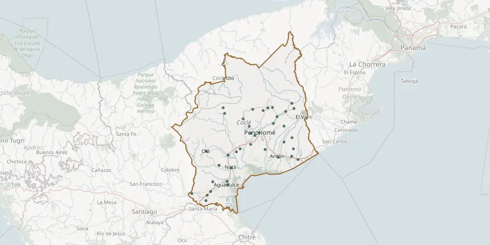 © OpenStreetMap
- Aguadulce Municipal CemeteryGPS coordinates: 8.24240° N, 80.53266° W
- Antón CemeteryGPS coordinates: 8.38833° N, 80.26097° W
- Bella Vista CemeteryGPS coordinates: 8.55336° N, 80.41762° W
- Cerro Marta CemeteryGPS coordinates: 8.65156° N, 80.55700° W
- Chiguirí Arriba CemeteryGPS coordinates: 8.67553° N, 80.18723° W
- Churubé CemeteryGPS coordinates: 8.39958° N, 80.53082° W
- Churuquita Chiquita CemeteryGPS coordinates: 8.56846° N, 80.28709° W
- Churuquita Grande CemeteryGPS coordinates: 8.60475° N, 80.26746° W
- Coclé Corregimiento CemeteryGPS coordinates: 8.45728° N, 80.40927° W
- El Chirú CemeteryGPS coordinates: 8.39388° N, 80.18875° W
- El Cortezo CemeteryGPS coordinates: 8.34581° N, 80.57897° W
- El Cristo CemeteryGPS coordinates: 8.25741° N, 80.61344° W
- El Roble CemeteryGPS coordinates: 8.18610° N, 80.64340° W
- El Roble CemeteryGPS coordinates: 8.15685° N, 80.64969° W
- El Rosario CemeteryGPS coordinates: 8.42999° N, 80.33103° W
- El Silencio CemeteryGPS coordinates: 8.51668° N, 80.40807° W
- Garicin CemeteryGPS coordinates: 8.43320° N, 80.46538° W
- Jardín de Paz CemeteryGPS coordinates: 8.65106° N, 80.31658° W
- La Pintada Municipal CemeteryGPS coordinates: 8.59292° N, 80.45004° W
- La Salitrosa CemeteryGPS coordinates: 8.20639° N, 80.62438° W
- Las Minas CemeteryGPS coordinates: 8.64386° N, 80.39783° W
- Llano Grande CemeteryGPS coordinates: 8.43370° N, 80.17881° W
- Llano Santos CemeteryGPS coordinates: 8.19502° N, 80.72551° W
- Loma Grande CemeteryGPS coordinates: 8.64843° N, 80.17657° W
- Los González CemeteryGPS coordinates: 8.46937° N, 80.22906° W
- Machuca CemeteryGPS coordinates: 8.62152° N, 80.54891° W
- Natá CemeteryGPS coordinates: 8.33145° N, 80.51276° W
- Oajaca CemeteryGPS coordinates: 8.63133° N, 80.22065° W
- Olá Municipal CemeteryGPS coordinates: 8.42031° N, 80.64782° W
- Peace Garden Cemetery, San José del NaranjalGPS coordinates: 8.63721° N, 80.34181° W