
Panamá Oeste
29 known cemeteries in Panamá Oeste, Panama.
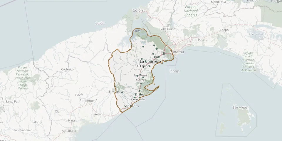 © OpenStreetMap
- Arraiján Municipal CemeteryGPS coordinates: 8.95046° N, 79.65413° W
- Bejuco Municipal CemeteryGPS coordinates: 8.61131° N, 79.88157° W
- Burunga CemeteryGPS coordinates: 8.95946° N, 79.65633° W
- Cabuya CemeteryGPS coordinates: 8.57469° N, 79.91953° W
- Cermeño CemeteryGPS coordinates: 8.73661° N, 79.84852° W
- Chame Municipal CemeteryGPS coordinates: 8.58100° N, 79.87615° W
- Colinas de la PazGPS coordinates: 8.92346° N, 79.73929° W
- El Arado CemeteryGPS coordinates: 8.95241° N, 79.75563° W
- El Aromo CemeteryGPS coordinates: 8.59759° N, 80.04587° W
- El Tamarindal Cemetery, Los CorozalesGPS coordinates: 8.90605° N, 79.86072° W
- Gorgona CemeteryGPS coordinates: 8.55074° N, 79.87806° W
- Juan Demóstenes Arosemena Municipal CemeteryGPS coordinates: 8.92160° N, 79.71834° W
- La Chorrera Municipal CemeteryGPS coordinates: 8.88323° N, 79.77127° W
- La Mitra CemeteryGPS coordinates: 8.83863° N, 79.78708° W
- Las Lajas CemeteryGPS coordinates: 8.54930° N, 79.92684° W
- Lídice Cemetery AnnexGPS coordinates: 8.74821° N, 79.90322° W
- Mendoza CemeteryGPS coordinates: 9.01862° N, 79.84804° W
- Municipal de Vista AlegreGPS coordinates: 8.92374° N, 79.70124° W
- Nuevo Emperador CemeteryGPS coordinates: 9.00463° N, 79.71990° W
- Padre Amable Generoso Franco CemeteryGPS coordinates: 8.76036° N, 79.87530° W
- Paja Muslim CemeteryGPS coordinates: 8.99502° N, 79.72273° W
- Potrero Grande Municipal CemeteryGPS coordinates: 8.88103° N, 79.82582° W
- Puerto Caimito CemeteryGPS coordinates: 8.86802° N, 79.71230° W
- Punta Chame CemeteryGPS coordinates: 8.64305° N, 79.70902° W
- Río Indio Nacimiento CemeteryGPS coordinates: 8.65306° N, 80.11191° W
- Sajalices CemeteryGPS coordinates: 8.67795° N, 79.86672° W
- San Carlos Municipal CemeteryGPS coordinates: 8.47050° N, 79.95388° W
- Santa Clara Cemetery, HuileGPS coordinates: 9.03044° N, 79.74482° W
- Veracruz CemeteryGPS coordinates: 8.88666° N, 79.63354° W