
La Libertad
50 known cemeteries in La Libertad, Peru.
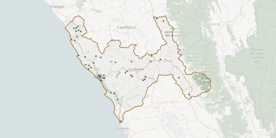 © OpenStreetMap
- Ascope Municipal CemeteryGPS coordinates: 7.71178° S, 79.10050° W
- Cachicadan CemeteryGPS coordinates: 8.10449° S, 78.14950° W
- CampoSanto Parque Eterno CemeteryGPS coordinates: 8.09885° S, 79.05972° W
- Cartavio CemeteryGPS coordinates: 7.89133° S, 79.22943° W
- Challas CemeteryGPS coordinates: 8.43622° S, 77.31986° W
- Chao General CemeteryGPS coordinates: 8.52948° S, 78.68171° W
- Chepén CemeteryGPS coordinates: 7.21936° S, 79.43126° W
- Chicama CemeteryGPS coordinates: 7.83876° S, 79.14058° W
- Chicama CemeteryGPS coordinates: 7.84197° S, 79.14263° W
- Chillia Municipal CemeteryGPS coordinates: 8.11989° S, 77.51462° W
- Chiquitoy CemeteryGPS coordinates: 7.92820° S, 79.19100° W
- Chugay CemeteryGPS coordinates: 7.77461° S, 77.86643° W
- Conra-Miraflores CemeteryGPS coordinates: 8.17056° S, 78.19741° W
- Descanso Eterno Municipal Cemetery, Campo NuevoGPS coordinates: 8.94076° S, 78.62648° W
- El Ángel Cemetery, PacanguillaGPS coordinates: 7.14886° S, 79.44450° W
- Jardines de la PazGPS coordinates: 8.08376° S, 79.01541° W
- Julia Sanchez Mendizabal CemeteryGPS coordinates: 7.72800° S, 79.30543° W
- Laredo CemeteryGPS coordinates: 8.07388° S, 78.94827° W
- Los Ángeles Cemetery (San Ignacio la Libertad)GPS coordinates: 7.82868° S, 78.72171° W
- Mache CemeteryGPS coordinates: 8.02748° S, 78.53539° W
- Magdalena de Cao CemeteryGPS coordinates: 7.87450° S, 79.29445° W
- Malabrigo CemeteryGPS coordinates: 7.69927° S, 79.43118° W
- Mampuesto CemeteryGPS coordinates: 8.08000° S, 79.01056° W
- Miraflores General CemeteryGPS coordinates: 8.10147° S, 79.02460° W
- Miramar CemeteryGPS coordinates: 8.17482° S, 78.98987° W
- Moche CemeteryGPS coordinates: 8.16565° S, 79.00825° W
- Motil CemeteryGPS coordinates: 7.99512° S, 78.50458° W
- Nuestra Señora del Carmelo Cemetery, El CarmenGPS coordinates: 7.17483° S, 79.47618° W
- Pacasmayo CemeteryGPS coordinates: 7.39640° S, 79.56970° W
- Pampas de San Juan CemeteryGPS coordinates: 8.12954° S, 78.94562° W