
Puno
54 known cemeteries in Puno, Peru.
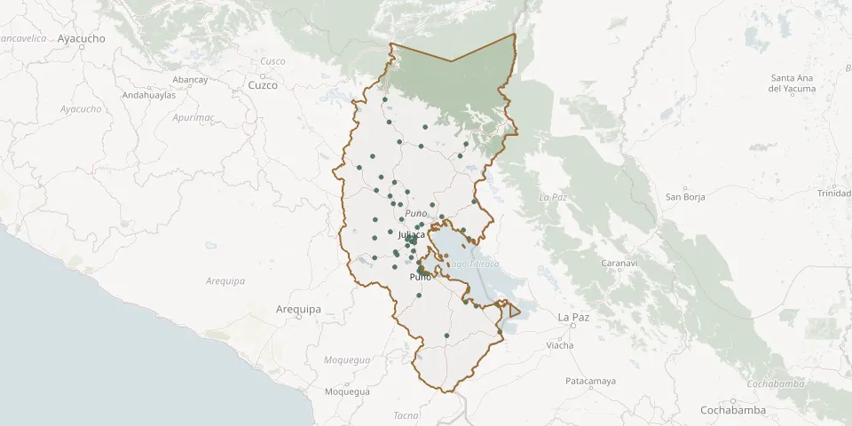 © OpenStreetMap
- Laykakota General CemeteryGPS coordinates: 15.84882° S, 70.02034° W
- Los Ángeles Cemetery, JuliacaGPS coordinates: 15.47599° S, 70.10440° W
- Mañazo Municipal CemeteryGPS coordinates: 15.79948° S, 70.34761° W
- Moho CemeteryGPS coordinates: 15.35753° S, 69.50044° W
- Nicasio CemeteryGPS coordinates: 15.23102° S, 70.26557° W
- Nuñoa General CemeteryGPS coordinates: 14.47720° S, 70.62408° W
- Ollachea Municipal CemeteryGPS coordinates: 13.79717° S, 70.46995° W
- Palca CemeteryGPS coordinates: 15.23589° S, 70.59000° W
- Paratía General CemeteryGPS coordinates: 15.45220° S, 70.59909° W
- Pata Pampa General CemeteryGPS coordinates: 14.06468° S, 70.41724° W
- Paucarcolla District CemeteryGPS coordinates: 15.74715° S, 70.05208° W
- Pucará Central CemeteryGPS coordinates: 15.04219° S, 70.36608° W
- Sacaca CemeteryGPS coordinates: 14.72479° S, 70.51846° W
- Saman CemeteryGPS coordinates: 15.28985° S, 70.01412° W
- Sandia CemeteryGPS coordinates: 14.32692° S, 69.46627° W
- San Marcos de Chilla CemeteryGPS coordinates: 15.50907° S, 70.10349° W
- Santa Lucía General CemeteryGPS coordinates: 15.69024° S, 70.59662° W
- Santa Rosa Municipal CemeteryGPS coordinates: 14.61157° S, 70.78868° W
- Santiago de Pupuja CemeteryGPS coordinates: 15.05619° S, 70.28131° W
- Tirapata CemeteryGPS coordinates: 14.95288° S, 70.40616° W
- Usicayos CemeteryGPS coordinates: 14.12663° S, 69.97059° W
- Ventilla CemeteryGPS coordinates: 15.84570° S, 70.04830° W
- Yanamayo PunoGPS coordinates: 15.81037° S, 70.03091° W
- Yunguyo General CemeteryGPS coordinates: 16.23960° S, 69.09025° W