
San Martín
19 known cemeteries in San Martín, Peru.
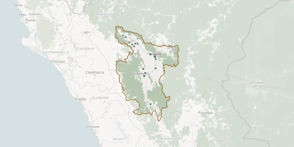 © OpenStreetMap
- Banda de Shilcayo General CemeteryGPS coordinates: 6.48731° S, 76.34923° W
- Calzada CemeteryGPS coordinates: 6.03660° S, 77.06716° W
- Elías Soplín Vargas Municipal CemeteryGPS coordinates: 5.98616° S, 77.27436° W
- Jardines del Eden Park CemeteryGPS coordinates: 6.51769° S, 76.34453° W
- Juan Guerra General CemeteryGPS coordinates: 6.58660° S, 76.32674° W
- Juanjuicillo CemeteryGPS coordinates: 7.19420° S, 76.74231° W
- Lamas Public CemeteryGPS coordinates: 6.41827° S, 76.51358° W
- Los Angeles CemeteryGPS coordinates: 6.13487° S, 77.10663° W
- Moyobamba General CemeteryGPS coordinates: 6.02542° S, 76.98654° W
- Naranjillo CemeteryGPS coordinates: 5.80327° S, 77.40076° W
- Pardo Miguel Municipal Cemetery, NaranjosGPS coordinates: 5.74371° S, 77.49872° W
- Picota CemeteryGPS coordinates: 6.91580° S, 76.33712° W
- Rioja General CemeteryGPS coordinates: 6.06890° S, 77.17218° W
- Sacanche General CemeteryGPS coordinates: 7.07481° S, 76.70670° W
- San Juan Bautista General CemeteryGPS coordinates: 7.17869° S, 76.73811° W
- Saposoa Second Quarter CemeteryGPS coordinates: 6.92948° S, 76.77850° W
- Tarapoto General CemeteryGPS coordinates: 6.48660° S, 76.36887° W
- Tocache CemeteryGPS coordinates: 8.18486° S, 76.51084° W
- Virgen del Carmen CemeteryGPS coordinates: 6.94210° S, 76.76870° W