
Łódź Voivodeship
732 known cemeteries in Łódź Voivodeship, Poland.
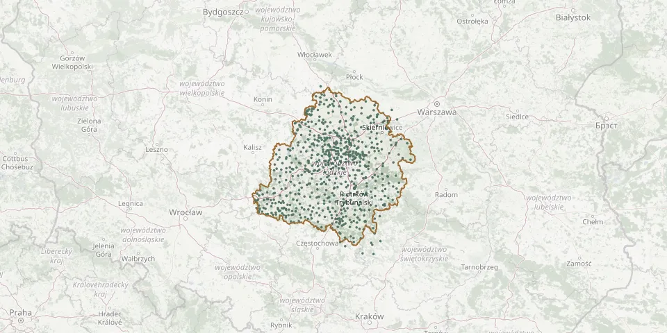 © OpenStreetMap
- Cekanów Lutheran CemeteryGPS coordinates: 51.54231° N, 20.01750° E
- St. Dorothy Parish Cemetery, Łódź-MileszkiGPS coordinates: 51.76804° N, 19.57315° E
- Działoszyn CemeteryGPS coordinates: 51.11940° N, 18.85409° E
- Oszkowice CemeteryGPS coordinates: 52.07047° N, 19.56375° E
- Radomsko New CemeteryGPS coordinates: 51.06015° N, 19.46457° E
- All Saints and St. James Parish Cemetery, GiecznoGPS coordinates: 51.99799° N, 19.45154° E
- All Saints Parish Cemetery, StrzelceGPS coordinates: 52.31214° N, 19.40975° E
- Ozorków Old CemeteryGPS coordinates: 51.95554° N, 19.30642° E
- Pieczew Parish CemeteryGPS coordinates: 52.13669° N, 18.91548° E
- Srock Catholic CemeteryGPS coordinates: 51.53646° N, 19.62127° E
- St. Alexander Orthodox Cemetery, Łódź-DołyGPS coordinates: 51.78399° N, 19.48676° E
- Łódź-Doły Municipal CemeteryGPS coordinates: 51.78614° N, 19.48548° E
- Rzgów Parish Cemetery with St. Michael the Archangel ChapelGPS coordinates: 51.66508° N, 19.48475° E
- St. Lawrence Cemetery, SzadekGPS coordinates: 51.68174° N, 18.97377° E
- Strzegocin Parish CemeteryGPS coordinates: 52.16370° N, 19.35750° E
- Szczyty Parish CemeteryGPS coordinates: 51.14919° N, 18.83563° E
- Żelechlinek CemeteryGPS coordinates: 51.70735° N, 20.03233° E
- Łódź Baptist Cemetery (Doły)GPS coordinates: 51.78631° N, 19.49060° E
- St. Catherine Parish Cemetery, WitoniaGPS coordinates: 52.14909° N, 19.28899° E
- Stolec CemeteryGPS coordinates: 51.36829° N, 18.68591° E
- St. Peter and St. Paul Parish Cemetery, SobotaGPS coordinates: 52.11652° N, 19.68221° E
- Zelów Evangelical Reformed CemeteryGPS coordinates: 51.47137° N, 19.22034° E
- Aleksandrów Łódzki Roman Catholic CemeteryGPS coordinates: 51.81992° N, 19.31331° E
- Budziszewice Catholic Parish CemeteryGPS coordinates: 51.66720° N, 19.92771° E
- Krzepczów Parish CemeteryGPS coordinates: 51.45498° N, 19.49017° E
- Sieradz Parish CemeteryGPS coordinates: 51.60933° N, 18.62104° E
- St. Mary Magdalene Parish Cemetery, KalinowaGPS coordinates: 51.69291° N, 18.48729° E
- Brzeziny CemeteryGPS coordinates: 51.80248° N, 19.73486° E
- Drobnice Parish CemeteryGPS coordinates: 51.21470° N, 18.77950° E
- Kutno CemeteryGPS coordinates: 52.23713° N, 19.35023° E