
Lower Silesian Voivodeship
1,407 known cemeteries in Lower Silesian Voivodeship, Poland.
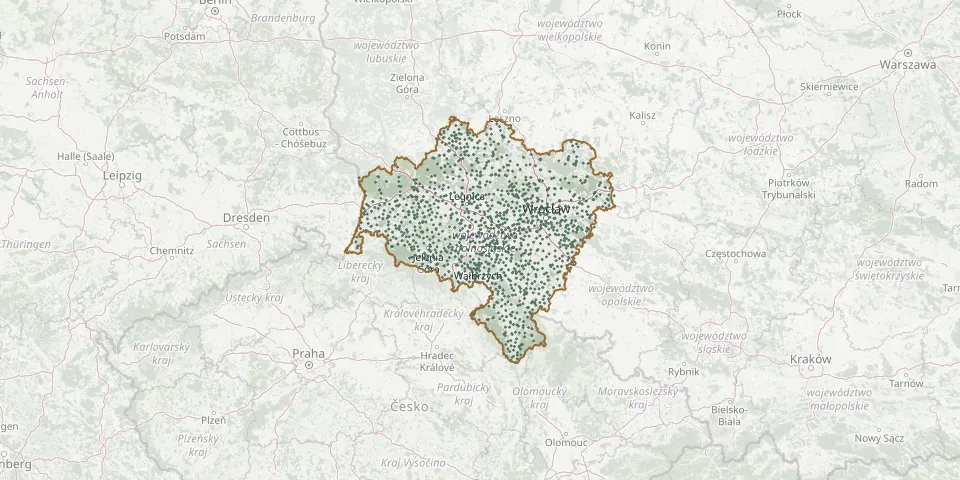 © OpenStreetMap
- Wińsko CemeteryGPS coordinates: 51.47343° N, 16.61982° E
- Wińsko Jewish CemeteryGPS coordinates: 51.47496° N, 16.60050° E
- Wińsko Parish CemeteryGPS coordinates: 51.41356° N, 16.47395° E
- Witków Evangelical Cemetery (now Roman Catholic)GPS coordinates: 50.88690° N, 16.42661° E
- Witków Evangelical Cemetery (now Roman Catholic Churchyard)GPS coordinates: 50.79695° N, 16.13247° E
- Witosławice Abandoned CemeteryGPS coordinates: 50.68023° N, 17.04937° E
- Wleń Evangelical Cemetery (now Roman Catholic)GPS coordinates: 51.01271° N, 15.67283° E
- Wleń Municipal CemeteryGPS coordinates: 51.01271° N, 15.67282° E
- Wleń Parish CemeteryGPS coordinates: 51.01573° N, 15.67174° E
- Wleński Gródek Old CemeteryGPS coordinates: 51.01626° N, 15.65751° E
- Włodzice Wielkie Old Roman Catholic CemeteryGPS coordinates: 51.18288° N, 15.55262° E
- Wojanów Evangelical Cemetery (now Roman Catholic)GPS coordinates: 50.87263° N, 15.82132° E
- Wojbórz Roman Catholic ChurchyardGPS coordinates: 50.51149° N, 16.64522° E
- Wojciechów CemeteryGPS coordinates: 50.99640° N, 15.56377° E
- Wojciechowice Parish CemeteryGPS coordinates: 50.45184° N, 16.70717° E
- Wojcieszyce Roman Catholic ChurchyardGPS coordinates: 50.88595° N, 15.62810° E
- Wojcieszyn CemeteryGPS coordinates: 51.14396° N, 15.83160° E
- Wojnowice Former Evangelical CemeteryGPS coordinates: 51.06238° N, 17.26699° E
- Wojnowice Municipal CemeteryGPS coordinates: 51.05901° N, 17.25114° E
- Wojszyn Evangelical CemeteryGPS coordinates: 51.65787° N, 16.18493° E
- Wojtkowice Roman Catholic ChurchyardGPS coordinates: 51.01316° N, 16.81634° E
- Wójtowice Roman Catholic CemeteryGPS coordinates: 50.30285° N, 16.56321° E
- Wolibórz Roman Catholic ChurchyardGPS coordinates: 50.58779° N, 16.55378° E
- Wolimierz ChurchyardGPS coordinates: 50.95775° N, 15.31811° E
- Wołów CemeteryGPS coordinates: 51.32557° N, 16.62373° E
- Wołów Cemetery (closed)GPS coordinates: 51.33666° N, 16.64185° E
- Wołów Municipal CemeteryGPS coordinates: 51.34610° N, 16.65370° E
- Wołów Soviet Army War CemeteryGPS coordinates: 51.34633° N, 16.65572° E
- Wrocisławice Roman Catholic CemeteryGPS coordinates: 51.12672° N, 16.48946° E
- Wrocisławice Roman Catholic ChurchyardGPS coordinates: 51.12924° N, 16.49273° E