
Lower Silesian Voivodeship
1,407 known cemeteries in Lower Silesian Voivodeship, Poland.
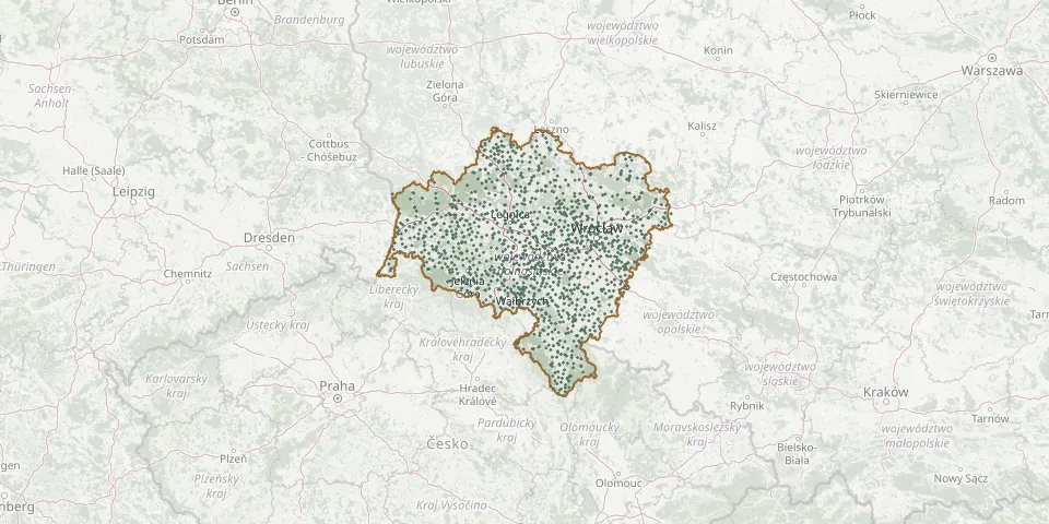 © OpenStreetMap
- Wierzchowice CemeteryGPS coordinates: 51.62551° N, 15.96279° E
- Witoszów Dolny CemeteryGPS coordinates: 50.82619° N, 16.42860° E
- Wysoka Municipal CemeteryGPS coordinates: 51.48457° N, 15.83672° E
- Góra Parish CemeteryGPS coordinates: 51.67772° N, 16.54540° E
- Jelcz-Laskowice Parish CemeteryGPS coordinates: 51.02000° N, 17.32459° E
- Kowary New Municipal CemeteryGPS coordinates: 50.78918° N, 15.82353° E
- Księżyce CemeteryGPS coordinates: 50.77637° N, 17.19604° E
- Ludów Śląski Parish CemeteryGPS coordinates: 50.84345° N, 17.03154° E
- Roztocznik CemeteryGPS coordinates: 50.74113° N, 16.73588° E
- Ubocze CemeteryGPS coordinates: 51.05589° N, 15.42105° E
- Wilczków Parish CemeteryGPS coordinates: 50.96536° N, 16.98788° E
- Zbytowa CemeteryGPS coordinates: 51.11952° N, 17.42811° E
- Bolesławiec War Cemetery named after M. KutuzowGPS coordinates: 51.25556° N, 15.51361° E
- Chwalibożyce CemeteryGPS coordinates: 50.87607° N, 17.31381° E
- Kościół pw. świętego Jana ChrzcicielaGPS coordinates: 50.49036° N, 16.32779° E
- Niemcza Municipal CemeteryGPS coordinates: 50.72005° N, 16.83289° E
- Nowizna CemeteryGPS coordinates: 50.75311° N, 16.61406° E
- Ostroszowice CemeteryGPS coordinates: 50.64641° N, 16.64011° E
- Prusy CemeteryGPS coordinates: 50.75184° N, 16.93368° E
- Spalona CemeteryGPS coordinates: 51.23991° N, 16.28419° E
- Stronie Śląskie Parish CemeteryGPS coordinates: 50.29694° N, 16.87133° E
- Trzmielów Catholic Parish CemeteryGPS coordinates: 51.42819° N, 16.00438° E
- Church of the Visitation Churchyard, NiemojówGPS coordinates: 50.16621° N, 16.56233° E
- Gałów Parish CemeteryGPS coordinates: 51.11058° N, 16.81464° E
- Jedlina Zdrój Municipal CemeteryGPS coordinates: 50.72315° N, 16.34442° E
- Kochanów CemeteryGPS coordinates: 50.68621° N, 16.15194° E
- Krzekotów Municipal CemeteryGPS coordinates: 51.69966° N, 16.16092° E
- Kudowa-Zdrój St. Bartholomew the Apostle Parish Cemetery (Czermna)GPS coordinates: 50.45096° N, 16.24236° E
- Kurowice Parish Cemetery (Exaltation of the Holy Cross)GPS coordinates: 51.63697° N, 16.04079° E
- Piskorzów Parish CemeteryGPS coordinates: 50.73406° N, 16.56512° E