
Podlaskie Voivodeship
670 known cemeteries in Podlaskie Voivodeship, Poland.
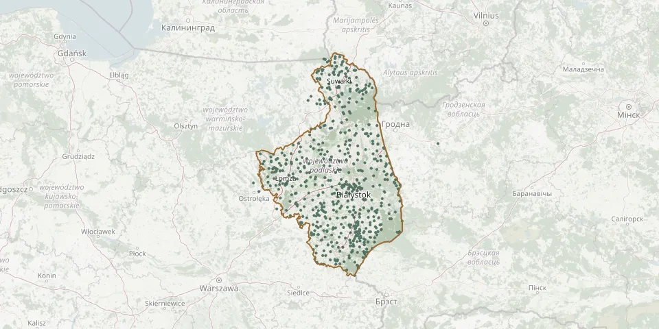 © OpenStreetMap
- Wojny-Krupy Parish CemeteryGPS coordinates: 52.80476° N, 22.57717° E
- Wojska Polskiego CemeteryGPS coordinates: 54.35082° N, 22.70633° E
- Wojtki Parish CemeteryGPS coordinates: 52.65856° N, 22.92750° E
- Wola Zambrowska Municipal CemeteryGPS coordinates: 52.96005° N, 22.25665° E
- Wólka Karwowska Parish CemeteryGPS coordinates: 53.70259° N, 22.78194° E
- Wólka Terechowska Orthodox CemeteryGPS coordinates: 52.51084° N, 23.38348° E
- Wólka Wygonowska Orthodox CemeteryGPS coordinates: 52.62184° N, 23.26181° E
- Wróble World War I CemeteryGPS coordinates: 52.94707° N, 22.55735° E
- Wygoda Parish CemeteryGPS coordinates: 53.06806° N, 22.16599° E
- Wysoka Góra Old Believers' Cemetery, Krasnopol CommuneGPS coordinates: 54.13450° N, 23.11230° E
- Wysokie Mazowieckie CemeteryGPS coordinates: 52.92181° N, 22.50573° E
- Wysokie Mazowieckie New Jewish CemeteryGPS coordinates: 52.92310° N, 22.50920° E
- Wyszki Parish CemeteryGPS coordinates: 52.84423° N, 22.98802° E
- Wyszonki Kościelne Parish CemeteryGPS coordinates: 52.76326° N, 22.63119° E
- Zabłudów Orthodox CemeteryGPS coordinates: 53.02185° N, 23.34939° E
- Zabłudów Roman Catholic CemeteryGPS coordinates: 53.02392° N, 23.31381° E
- Zabłudów St. Roch CemeteryGPS coordinates: 53.01609° N, 23.32971° E
- Zabłudów Uniate CemeteryGPS coordinates: 53.02095° N, 23.34739° E
- Zagroby Zakrzewo Parish CemeteryGPS coordinates: 53.00415° N, 22.14132° E
- Zajdy World War I CemeteryGPS coordinates: 53.96755° N, 22.43019° E
- Zalesie Catholic CemeteryGPS coordinates: 53.55164° N, 23.54892° E
- Zalesie Our Lady of Consolation Parish ChurchyardGPS coordinates: 53.55574° N, 23.54598° E
- Zalesie Parish Cemetery (old, closed)GPS coordinates: 53.55604° N, 23.54691° E
- Zaleszany Orthodox CemeteryGPS coordinates: 52.64056° N, 23.32293° E
- Zambrów Jewish CemeteryGPS coordinates: 52.99043° N, 22.23585° E
- Zambrów Municipal CemeteryGPS coordinates: 52.97977° N, 22.23436° E
- Zambrów Soviet Prisoner-of-War CemeteryGPS coordinates: 52.97226° N, 22.25803° E
- Zambrów War Cemetery of Soviet Soldiers from World War IIGPS coordinates: 52.97210° N, 22.25771° E
- Zaśnięcia NMP CemeteryGPS coordinates: 53.12259° N, 23.07739° E
- Zawady Parish CemeteryGPS coordinates: 53.15762° N, 22.65938° E