
Podlaskie Voivodeship
670 known cemeteries in Podlaskie Voivodeship, Poland.
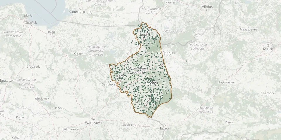 © OpenStreetMap
- Bombla Parish CemeteryGPS coordinates: 53.36093° N, 23.16188° E
- Borawskie War Cemetery (World War I)GPS coordinates: 53.32573° N, 22.37095° E
- Brańsk Jewish CemeteryGPS coordinates: 52.73351° N, 22.82496° E
- Brańsk Orthodox CemeteryGPS coordinates: 52.75018° N, 22.83396° E
- Brańsk Roman Catholic CemeteryGPS coordinates: 52.74809° N, 22.86836° E
- Brańsk Roman Catholic Cemetery (now Churchyard)GPS coordinates: 52.74237° N, 22.84184° E
- Bronowo Parish CemeteryGPS coordinates: 53.15476° N, 22.31705° E
- Brulino Koski Russian World War I War CemeteryGPS coordinates: 52.77448° N, 22.30951° E
- Bruszewo German War Cemetery (World War I)GPS coordinates: 52.98523° N, 22.62765° E
- Brzozowa Parish CemeteryGPS coordinates: 53.50558° N, 23.05906° E
- Budy Kozłówka War Cemetery (World War I)GPS coordinates: 53.29822° N, 21.98443° E
- Burzyn Podlaskie CemeteryGPS coordinates: 53.28010° N, 22.45210° E
- Bystre Orthodox CemeteryGPS coordinates: 52.60305° N, 23.11121° E
- Catholic cemetery in WiznaGPS coordinates: 53.18963° N, 22.38387° E
- Cedry Roman Catholic CemeteryGPS coordinates: 53.36642° N, 22.16543° E
- Chlebiotki Parish CemeteryGPS coordinates: 53.16580° N, 22.54402° E
- Chmielówka Stara Evangelical CemeteryGPS coordinates: 54.12135° N, 22.76285° E
- Chodorówka Nowa Parish CemeteryGPS coordinates: 53.54349° N, 23.09785° E
- Chojewo Roman Catholic CemeteryGPS coordinates: 52.69678° N, 22.95707° E
- Chojny Młode CemeteryGPS coordinates: 53.12063° N, 21.95668° E
- Chojny Młode Soviet Army War Cemetery from World War IGPS coordinates: 53.15705° N, 21.91450° E
- Chojny Młode World War I CemeteryGPS coordinates: 53.15760° N, 21.91384° E
- Chomontowce Orthodox CemeteryGPS coordinates: 53.16047° N, 23.90336° E
- Choroszcz Former Evangelical CemeteryGPS coordinates: 53.14692° N, 22.97023° E
- Choroszcz Jewish CemeteryGPS coordinates: 53.14833° N, 23.00563° E
- Choroszcz Roman Catholic CemeteryGPS coordinates: 53.13587° N, 22.97645° E
- Ciechanowiec Cemetery and Monument from World War IGPS coordinates: 52.68183° N, 22.51149° E
- Ciechanowiec Evangelical CemeteryGPS coordinates: 52.68450° N, 22.51805° E
- Ciechanowiec Jewish CemeteryGPS coordinates: 52.68288° N, 22.52242° E
- Ciechanowiec Orthodox CemeteryGPS coordinates: 52.68514° N, 22.51975° E