
Silesian Voivodeship
1,036 known cemeteries in Silesian Voivodeship, Poland.
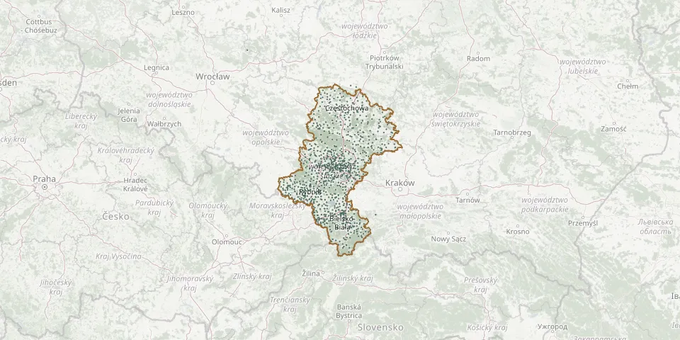 © OpenStreetMap
- Łodygowice Parish CemeteryGPS coordinates: 49.72615° N, 19.15576° E
- Lubecko Assumption of the Blessed Virgin Mary Parish CemeteryGPS coordinates: 50.69807° N, 18.65446° E
- Lubliniec Jewish CemeteryGPS coordinates: 50.66261° N, 18.68313° E
- Lubliniec Military CemeteryGPS coordinates: 50.65986° N, 18.68775° E
- Lubliniec Municipal CemeteryGPS coordinates: 50.66316° N, 18.66751° E
- Lubliniec Municipal CemeteryGPS coordinates: 50.60356° N, 18.71107° E
- Lubliniec Parish CemeteryGPS coordinates: 50.66852° N, 18.69006° E
- Lubojna Parish CemeteryGPS coordinates: 50.89366° N, 19.12239° E
- Lubomia Parish CemeteryGPS coordinates: 50.03958° N, 18.30741° E
- Lubomia Soviet War CemeteryGPS coordinates: 50.04471° N, 18.30455° E
- Łubowice Old Parish CemeteryGPS coordinates: 50.16091° N, 18.23256° E
- Łubowice Parish CemeteryGPS coordinates: 50.16004° N, 18.22850° E
- Lubsza Roman Catholic ChurchyardGPS coordinates: 50.61203° N, 18.99895° E
- Ługi Radły Parish CemeteryGPS coordinates: 50.83810° N, 18.67231° E
- Łysiny Roman Catholic CemeteryGPS coordinates: 50.82536° N, 19.66276° E
- Lyski New CemeteryGPS coordinates: 50.11892° N, 18.39224° E
- Lyski Parish CemeteryGPS coordinates: 50.11713° N, 18.38606° E
- Małusy Wielkie CemeteryGPS coordinates: 50.79531° N, 19.31703° E
- Markowice CemeteryGPS coordinates: 50.11451° N, 18.27513° E
- Marusze Lutheran CemeteryGPS coordinates: 49.98441° N, 18.46012° E
- Mater Dolorosa Cemetery II, BytomGPS coordinates: 50.35535° N, 18.92122° E
- Mazańcowice Lutheran CemeteryGPS coordinates: 49.85699° N, 18.98768° E
- Mazańcowice Parish CemeteryGPS coordinates: 49.85976° N, 18.98014° E
- Mełchów Grave of the 1863 InsurgentsGPS coordinates: 50.71753° N, 19.60761° E
- Memorial Park Municipal Cemetery, Ruda ŚląskaGPS coordinates: 50.24894° N, 18.89144° E
- Meszna Parish CemeteryGPS coordinates: 49.74684° N, 19.05354° E
- Miasteczko Śląskie Jewish CemeteryGPS coordinates: 50.48672° N, 18.92469° E
- Miasteczko Śląskie Roman Catholic CemeteryGPS coordinates: 50.48695° N, 18.94954° E
- Miechowice War PlotGPS coordinates: 50.36281° N, 18.92408° E
- Miedary St. Florian Parish CemeteryGPS coordinates: 50.44667° N, 18.76306° E