
Castelo Branco
186 known cemeteries in Castelo Branco, Portugal.
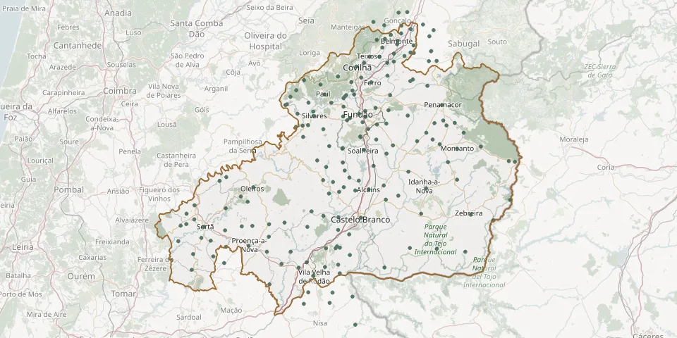 © OpenStreetMap
- Benquerenças CemeteryGPS coordinates: 39.79545° N, 7.57993° W
- Boavista Neighbourhood CemeteryGPS coordinates: 40.24985° N, 7.48979° W
- Bogas de Cima CemeteryGPS coordinates: 40.07297° N, 7.71650° W
- Borralheira CemeteryGPS coordinates: 40.31216° N, 7.41895° W
- Cabeçudo CemeteryGPS coordinates: 39.82691° N, 8.13953° W
- Cacheiro CemeteryGPS coordinates: 39.57357° N, 7.71358° W
- Cafede CemeteryGPS coordinates: 39.91337° N, 7.51278° W
- Canhoso CemeteryGPS coordinates: 40.29391° N, 7.47893° W
- Capinha CemeteryGPS coordinates: 40.19797° N, 7.37740° W
- Cardigos CemeteryGPS coordinates: 39.69583° N, 8.02412° W
- Caria CemeteryGPS coordinates: 40.29740° N, 7.36305° W
- Carvalhal CemeteryGPS coordinates: 39.86923° N, 8.13894° W
- Carvalhal Formoso CemeteryGPS coordinates: 40.31459° N, 7.32187° W
- Casegas CemeteryGPS coordinates: 40.17549° N, 7.69526° W
- Castanheiras CemeteryGPS coordinates: 40.29420° N, 7.38790° W
- Casteleiro CemeteryGPS coordinates: 40.29884° N, 7.22614° W
- Castelo Novo CemeteryGPS coordinates: 40.07327° N, 7.49266° W
- Castelo Novo CemeteryGPS coordinates: 40.07470° N, 7.49335° W
- Cebolais de Baixo CemeteryGPS coordinates: 39.74040° N, 7.58927° W
- Cebolais de Cima CemeteryGPS coordinates: 39.74198° N, 7.57323° W
- Cegonhas Cemetery, RosmaninhalGPS coordinates: 39.73853° N, 7.19496° W
- Cerejal CemeteryGPS coordinates: 39.69806° N, 7.70199° W
- Cernache do Bonjardim CemeteryGPS coordinates: 39.80816° N, 8.19284° W
- Chão da Vã and Camões CemeteryGPS coordinates: 39.90420° N, 7.61560° W
- Colmeal da Torre CemeteryGPS coordinates: 40.38124° N, 7.33385° W
- Corgas CemeteryGPS coordinates: 39.80714° N, 7.91358° W
- Cortes do Meio CemeteryGPS coordinates: 40.25399° N, 7.58057° W
- Covilhã CemeteryGPS coordinates: 40.28307° N, 7.50845° W
- Cumeada CemeteryGPS coordinates: 39.77115° N, 8.11244° W
- Cunqueiros CemeteryGPS coordinates: 39.81186° N, 7.84840° W