
Setúbal
53 known cemeteries in Setúbal, Portugal.
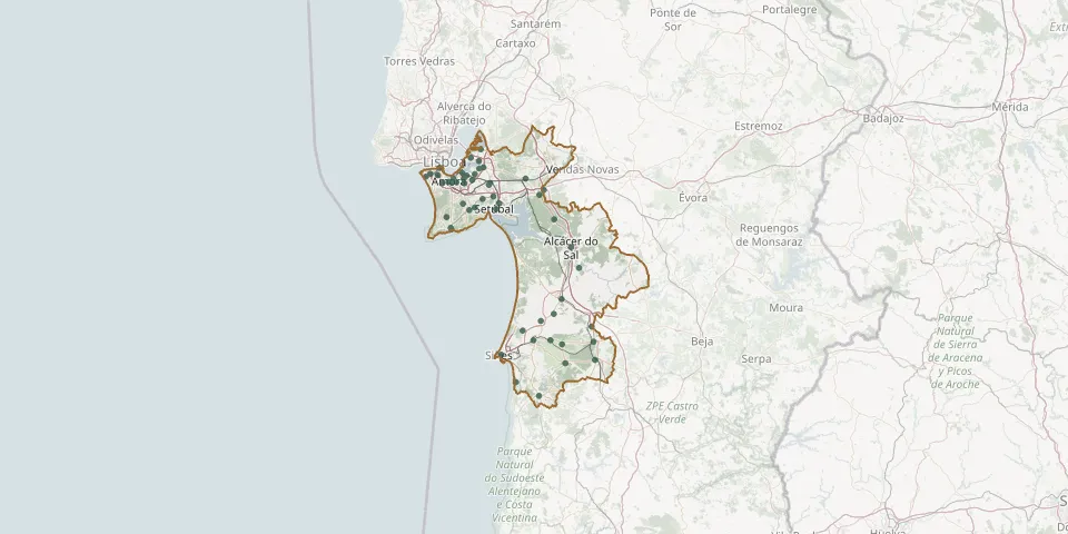 © OpenStreetMap
- Pinhal Novo Old CemeteryGPS coordinates: 38.62392° N, 8.91399° W
- Poceirão CemeteryGPS coordinates: 38.64072° N, 8.73864° W
- Porto Covo CemeteryGPS coordinates: 37.85191° N, 8.78535° W
- Quinta do Anjo CemeteryGPS coordinates: 38.56208° N, 8.94989° W
- Samouco CemeteryGPS coordinates: 38.72103° N, 9.00849° W
- Santa Margarida da Serra CemeteryGPS coordinates: 38.11663° N, 8.59936° W
- Santa Marta do Pinhal CemeteryGPS coordinates: 38.62266° N, 9.14903° W
- Santiago do Cacém Municipal CemeteryGPS coordinates: 38.01435° N, 8.69847° W
- Santo André CemeteryGPS coordinates: 38.05291° N, 8.75211° W
- São Bartolomeu da Serra CemeteryGPS coordinates: 38.01477° N, 8.61560° W
- São Domingos CemeteryGPS coordinates: 37.92602° N, 8.54112° W
- São Francisco da Serra CemeteryGPS coordinates: 38.09026° N, 8.66342° W
- São Sebastião CemeteryGPS coordinates: 38.65883° N, 8.98790° W
- Seixal CemeteryGPS coordinates: 38.64061° N, 9.09484° W
- Sesimbra CemeteryGPS coordinates: 38.44546° N, 9.10317° W
- Sesimbra Municipal Cemetery (Quinta do Conde)GPS coordinates: 38.54362° N, 9.04717° W
- Sines CemeteryGPS coordinates: 37.95875° N, 8.85869° W
- Vale da Amoreira Municipal CemeteryGPS coordinates: 38.64386° N, 9.04229° W
- Vale do Guizo CemeteryGPS coordinates: 38.29637° N, 8.47487° W
- Vale Flores Municipal CemeteryGPS coordinates: 38.65339° N, 9.17089° W
- Vendas de Azeitão CemeteryGPS coordinates: 38.53010° N, 8.98900° W
- Vila Chã Municipal CemeteryGPS coordinates: 38.63998° N, 9.04294° W
- Vila Nogueira de Azeitão CemeteryGPS coordinates: 38.51952° N, 9.01525° W