
Harghita
111 known cemeteries in Harghita, Romania.
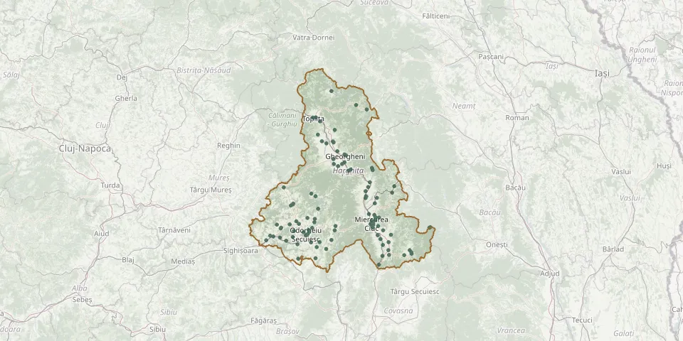 © OpenStreetMap
- Odorheiu Secuiesc Roman Catholic CemeteryGPS coordinates: 46.30028° N, 25.29586° E
- Odorheiu Secuiesc Reformed CemeteryGPS coordinates: 46.30490° N, 25.30090° E
- Unitarian CemeteryGPS coordinates: 46.30532° N, 25.30658° E
- Sândominic CemeteryGPS coordinates: 46.58374° N, 25.78946° E
- Praid Reformed Cemetery (Parajd)GPS coordinates: 46.55582° N, 25.12430° E
- Tulgheș Catholic CemeteryGPS coordinates: 46.96839° N, 25.76475° E
- Odorheiu Secuiesc Jewish CemeteryGPS coordinates: 46.30413° N, 25.30039° E
- Odorheiu Secuiesc Roman Catholic CemeteryGPS coordinates: 46.30163° N, 25.29651° E
- Bălan Catholic CemeteryGPS coordinates: 46.65934° N, 25.80445° E
- Bălan Old CemeteryGPS coordinates: 46.65747° N, 25.80635° E
- Bancu Roman Catholic CemeteryGPS coordinates: 46.30370° N, 25.95193° E
- Betești CemeteryGPS coordinates: 46.28869° N, 25.09407° E
- Bethlenfalva Roman Catholic CemeteryGPS coordinates: 46.31840° N, 25.31970° E
- Bilbor CemeteryGPS coordinates: 47.06682° N, 25.49194° E
- Bisericani Catholic CemeteryGPS coordinates: 46.36171° N, 25.24078° E
- Bodogaia CemeteryGPS coordinates: 46.27463° N, 24.98849° E
- Brădești Catholic CemeteryGPS coordinates: 46.34006° N, 25.34300° E
- Cădișeni Catholic Cemetery, Odorheiu SecuiescGPS coordinates: 46.32911° N, 25.31609° E
- Cârţa CemeteryGPS coordinates: 46.53563° N, 25.75626° E
- Casinu Nou CemeteryGPS coordinates: 46.19451° N, 26.05322° E
- Cemetery near Miercurea-CiucGPS coordinates: 46.35048° N, 25.85206° E
- Cemetery near Valea ReceGPS coordinates: 46.56205° N, 25.97656° E
- Chileni CemeteryGPS coordinates: 46.68125° N, 25.57399° E
- Ciceu Roman Catholic CemeteryGPS coordinates: 46.41538° N, 25.78145° E
- Cioboteni CemeteryGPS coordinates: 46.38380° N, 25.83048° E
- Cireșeni Cemetery (Sükő)GPS coordinates: 46.32399° N, 25.20267° E
- Ciumani CemeteryGPS coordinates: 46.68059° N, 25.51053° E
- Corbu Commune Orthodox Cemetery, HarghitaGPS coordinates: 46.99288° N, 25.68244° E
- Corund Catholic CemeteryGPS coordinates: 46.46580° N, 25.19376° E
- Corund Unitarian CemeteryGPS coordinates: 46.47119° N, 25.19772° E