
Perm Krai
48 known cemeteries in Perm Krai, Russia.
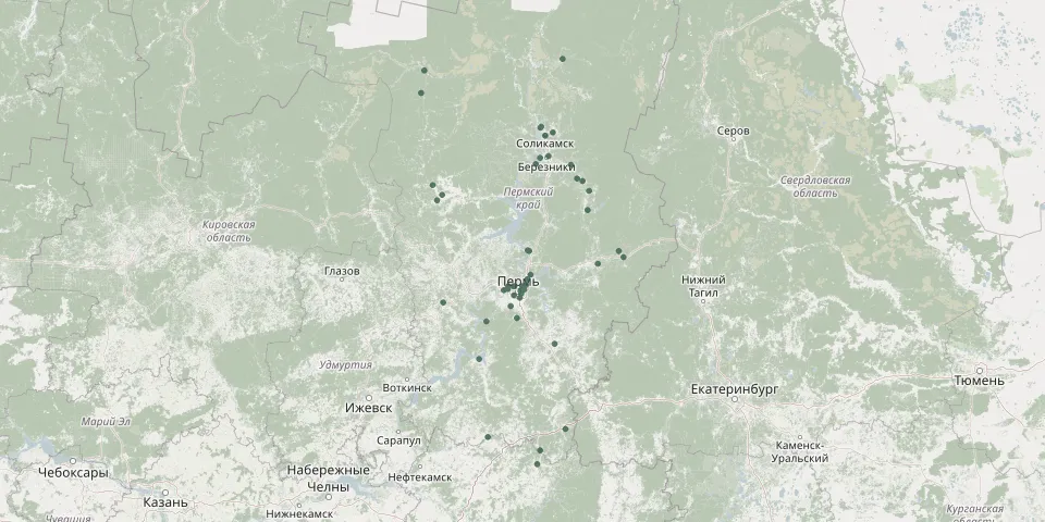 © OpenStreetMap
- Alexandrovsk CemeteryGPS coordinates: 59.17365° N, 57.52145° E
- Askino CemeteryGPS coordinates: 56.11397° N, 56.60972° E
- BakharevskoyeGPS coordinates: 57.94380° N, 56.25570° E
- Bannaya GoraGPS coordinates: 58.13905° N, 56.41216° E
- BeloevskoeGPS coordinates: 59.13274° N, 54.49782° E
- Church of the Prophet Elijah Churchyard, YugovskoeGPS coordinates: 57.72560° N, 56.19786° E
- Chusovoy CemeteryGPS coordinates: 58.30565° N, 57.83269° E
- Chyornoye CemeteryGPS coordinates: 59.67252° N, 56.92261° E
- DobryankaGPS coordinates: 58.44031° N, 56.44547° E
- GainyGPS coordinates: 60.29769° N, 54.33219° E
- Gornozavodsk CemeteryGPS coordinates: 58.37580° N, 58.34988° E
- IvanchinoGPS coordinates: 60.07188° N, 54.26185° E
- Kislotnye DatchiGPS coordinates: 58.07867° N, 56.38074° E
- KizelovskoyeGPS coordinates: 59.07129° N, 57.65349° E
- Krasnaya SludkaGPS coordinates: 58.19040° N, 56.47455° E
- Kuyeda Muslim CemeteryGPS coordinates: 56.41685° N, 55.61076° E
- Kuyeda Orthodox CemeteryGPS coordinates: 56.41888° N, 55.61291° E
- Malaya Serva CemeteryGPS coordinates: 59.02884° N, 54.69247° E
- Misharino New CemeteryGPS coordinates: 59.72981° N, 56.69252° E
- Nizhnyaya KuryaGPS coordinates: 58.03429° N, 56.01729° E
- OkulovskoyeGPS coordinates: 58.06442° N, 56.12388° E
- Orel Soviet Soldiers' War Cemetery, Usolsky DistrictGPS coordinates: 59.34837° N, 56.57854° E
- OsinskoyeGPS coordinates: 57.27889° N, 55.43548° E
- PashiyaGPS coordinates: 58.44046° N, 58.25677° E
- Perm Verkhnyaya Kuriya CemeteryGPS coordinates: 58.06438° N, 56.30654° E
- PeshnigortskoeGPS coordinates: 58.97118° N, 54.58926° E
- P. Zheleznodorozhnyy, Usolskiy rayon, Permskiy krayGPS coordinates: 59.43184° N, 56.83606° E
- SevernoyeGPS coordinates: 58.06542° N, 56.14456° E
- Snezhnoye CemeteryGPS coordinates: 56.50654° N, 57.17920° E
- SolikamskGPS coordinates: 59.63952° N, 56.77200° E