
Zabaykalsky Krai
42 known cemeteries in Zabaykalsky Krai, Russia.
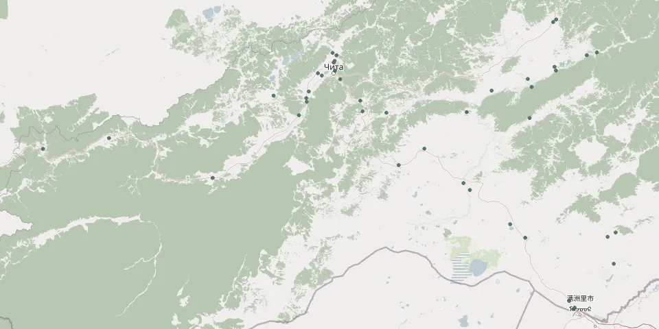 © OpenStreetMap
- Aginskoye CemeteryGPS coordinates: 51.11952° N, 114.54019° E
- Aleur 2-y CemeteryGPS coordinates: 52.56046° N, 117.06047° E
- Bada CemeteryGPS coordinates: 51.39013° N, 109.90223° E
- Baley CemeteryGPS coordinates: 51.59052° N, 116.63284° E
- Borzya CemeteryGPS coordinates: 50.38202° N, 116.56354° E
- Chernyshevsk CemeteryGPS coordinates: 52.53700° N, 117.01033° E
- Darasun CemeteryGPS coordinates: 51.65697° N, 113.96110° E
- Dunaevo CemeteryGPS coordinates: 52.06181° N, 117.05488° E
- Gorodskoye KlabdishcheGPS coordinates: 52.05978° N, 113.51873° E
- Ingoda CemeteryGPS coordinates: 51.85479° N, 113.09918° E
- KadalinskoeGPS coordinates: 52.01260° N, 113.30899° E
- Kalinino CemeteryGPS coordinates: 51.89860° N, 116.66595° E
- Karpovka CemeteryGPS coordinates: 52.21013° N, 113.54515° E
- Karymskoye CemeteryGPS coordinates: 51.64195° N, 114.34228° E
- Klichka CemeteryGPS coordinates: 50.43633° N, 118.01006° E
- Kokuy CemeteryGPS coordinates: 52.21163° N, 117.55105° E
- Krasnokamensk CemeteryGPS coordinates: 50.11488° N, 117.98153° E
- Makkaveevo CemeteryGPS coordinates: 51.76415° N, 113.92433° E
- Margutsek CemeteryGPS coordinates: 50.39200° N, 117.88266° E
- Matsievskaya CemeteryGPS coordinates: 49.73268° N, 117.26931° E
- Mogoytuy CemeteryGPS coordinates: 51.28421° N, 114.94870° E
- Nerchinsk CemeteryGPS coordinates: 51.97922° N, 116.60429° E
- Nizhnyaya Kuenga CemeteryGPS coordinates: 52.09763° N, 117.03289° E
- Novaya Kuka CemeteryGPS coordinates: 51.78726° N, 113.06092° E
- Olovyannaya CemeteryGPS coordinates: 50.93729° N, 115.57612° E
- Pervomaysky CemeteryGPS coordinates: 51.65058° N, 115.62907° E
- Peschanka CemeteryGPS coordinates: 51.97641° N, 113.60161° E
- Petrovsk-Zabaykalsky CemeteryGPS coordinates: 51.28263° N, 108.84675° E
- Rudnik Kadala CemeteryGPS coordinates: 52.03430° N, 113.24738° E
- Sherlovaya Gora CemeteryGPS coordinates: 50.51939° N, 116.32372° E