
Central Banat District
70 known cemeteries in Central Banat District, Serbia.
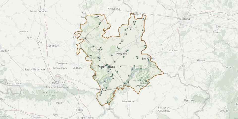 © OpenStreetMap
- Ečka Catholic CemeteryGPS coordinates: 45.31066° N, 20.45052° E
- Aleksandrovo CemeteryGPS coordinates: 45.63458° N, 20.60198° E
- Aradac CemeteryGPS coordinates: 45.38263° N, 20.30716° E
- Aradac Orthodox CemeteryGPS coordinates: 45.38929° N, 20.29252° E
- Banatska Dubica CemeteryGPS coordinates: 45.26709° N, 20.82317° E
- Banatski Despotovac CemeteryGPS coordinates: 45.36274° N, 20.66810° E
- Banatsko Karađorđevo CemeteryGPS coordinates: 45.57965° N, 20.55414° E
- Bašaidsko CemeteryGPS coordinates: 45.52961° N, 20.31887° E
- Belo Blato Slovak CemeteryGPS coordinates: 45.26835° N, 20.36549° E
- Bocar Catholic CemeteryGPS coordinates: 45.77031° N, 20.29164° E
- Botoš CemeteryGPS coordinates: 45.31054° N, 20.63068° E
- Centa CemeteryGPS coordinates: 45.10457° N, 20.39456° E
- Čestereg Old German CemeteryGPS coordinates: 45.56060° N, 20.53396° E
- Ečka Orthodox CemeteryGPS coordinates: 45.32332° N, 20.44898° E
- Elemir CemeteryGPS coordinates: 45.45093° N, 20.29165° E
- Elemir CemeteryGPS coordinates: 45.44548° N, 20.30783° E
- Elemir German CemeteryGPS coordinates: 45.42924° N, 20.30665° E
- Farkaždin CemeteryGPS coordinates: 45.18461° N, 20.46635° E
- Gradnuličko CemeteryGPS coordinates: 45.39612° N, 20.39149° E
- Hetin CemeteryGPS coordinates: 45.66435° N, 20.78361° E
- Jankov Most CemeteryGPS coordinates: 45.47057° N, 20.44330° E
- Jaša Tomić CemeteryGPS coordinates: 45.43372° N, 20.84853° E
- Klek CemeteryGPS coordinates: 45.41871° N, 20.47499° E
- Knićanin German CemeteryGPS coordinates: 45.18627° N, 20.32646° E
- Knićanin New CemeteryGPS coordinates: 45.17525° N, 20.32509° E
- Krajišnik CemeteryGPS coordinates: 45.44737° N, 20.72656° E
- Krajišnik Cemetery (Stefansfeld)GPS coordinates: 45.50651° N, 20.61957° E
- Krajišnik First Street CemeteryGPS coordinates: 45.45915° N, 20.72037° E
- Kumane CemeteryGPS coordinates: 45.53990° N, 20.23774° E
- Lazarevo CemeteryGPS coordinates: 45.38290° N, 20.54005° E