
Šumadija District
35 known cemeteries in Šumadija District, Serbia.
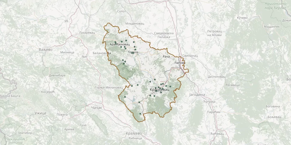 © OpenStreetMap
- Varoško CemeteryGPS coordinates: 44.01854° N, 20.92310° E
- Jovanovačko CemeteryGPS coordinates: 44.04731° N, 20.94894° E
- Bozman CemeteryGPS coordinates: 44.04418° N, 20.93221° E
- Šljivovac CemeteryGPS coordinates: 44.06112° N, 20.83401° E
- Arnautsko CemeteryGPS coordinates: 44.19240° N, 20.60640° E
- Banja CemeteryGPS coordinates: 44.27747° N, 20.60998° E
- Bare and Ljuljaci Village CemeteryGPS coordinates: 44.03377° N, 20.66831° E
- Belosavačko CemeteryGPS coordinates: 44.31996° N, 20.68536° E
- Beloševac CemeteryGPS coordinates: 43.99175° N, 20.93145° E
- Borač Old CemeteryGPS coordinates: 43.96160° N, 20.60593° E
- Bukovik CemeteryGPS coordinates: 44.31999° N, 20.51748° E
- Desimirovac CemeteryGPS coordinates: 44.07559° N, 20.87627° E
- Donja Šatornja CemeteryGPS coordinates: 44.17957° N, 20.59503° E
- Dragobraća CemeteryGPS coordinates: 43.97020° N, 20.83368° E
- Glavica Cemetery, Ribeški KrajGPS coordinates: 43.92677° N, 20.73352° E
- Gornja Šatornja CemeteryGPS coordinates: 44.20194° N, 20.58641° E
- Gornjekomaričko CemeteryGPS coordinates: 44.02964° N, 21.01634° E
- Grošnica CemeteryGPS coordinates: 43.96762° N, 20.87184° E
- Ilićevo CemeteryGPS coordinates: 44.01478° N, 20.94679° E
- Kikojevac CemeteryGPS coordinates: 44.04051° N, 20.72046° E
- Kopljare CemeteryGPS coordinates: 44.32999° N, 20.61573° E
- Kragujevac Serbian War CemeteryGPS coordinates: 44.02043° N, 20.88338° E
- Krćevac CemeteryGPS coordinates: 44.28912° N, 20.69249° E
- Leskovac CemeteryGPS coordinates: 43.85153° N, 20.74362° E
- Ljubeselo CemeteryGPS coordinates: 44.27083° N, 20.69821° E
- Maršić CemeteryGPS coordinates: 44.03368° N, 20.97842° E
- Mijajlovo Polje CemeteryGPS coordinates: 44.31164° N, 20.52230° E
- Oplenačko CemeteryGPS coordinates: 44.24918° N, 20.68077° E
- Palilulsko CemeteryGPS coordinates: 44.00144° N, 20.89362° E
- Stanovljansko CemeteryGPS coordinates: 44.00109° N, 20.88567° E