
Extremadura
372 known cemeteries in Extremadura, Spain.
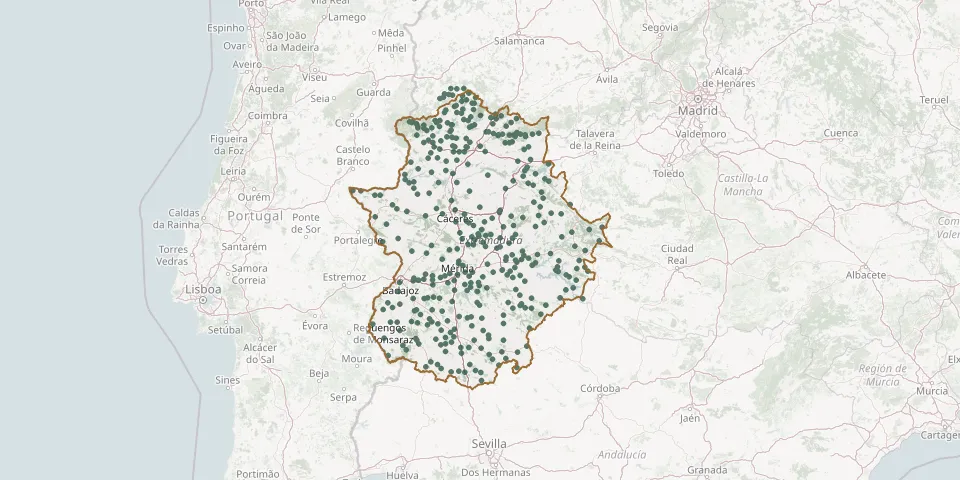 © OpenStreetMap
- Cespedosa de Agadones CemeteryGPS coordinates: 40.43149° N, 6.50193° W
- Cheles Municipal CemeteryGPS coordinates: 38.50482° N, 7.27560° W
- Cilleros Municipal CemeteryGPS coordinates: 40.11070° N, 6.79235° W
- Conquista de la Sierra CemeteryGPS coordinates: 39.34830° N, 5.73290° W
- Cordobilla de Lácara CemeteryGPS coordinates: 39.14192° N, 6.43529° W
- Coria Municipal CemeteryGPS coordinates: 39.99437° N, 6.54064° W
- Corte de Peleas Municipal CemeteryGPS coordinates: 38.73099° N, 6.67432° W
- Cristina Municipal CemeteryGPS coordinates: 38.83580° N, 6.10663° W
- Cuacos de Yuste CemeteryGPS coordinates: 40.09916° N, 5.71467° W
- Cuacos German Military CemeteryGPS coordinates: 40.11071° N, 5.73299° W
- Descargamaría CemeteryGPS coordinates: 40.30190° N, 6.48833° W
- Don Álvaro Municipal CemeteryGPS coordinates: 38.84592° N, 6.26726° W
- Don Benito Municipal CemeteryGPS coordinates: 38.96784° N, 5.85458° W
- El Batán Municipal CemeteryGPS coordinates: 39.97046° N, 6.39029° W
- El Carrascalejo Municipal CemeteryGPS coordinates: 39.02381° N, 6.33542° W
- El Gordo CemeteryGPS coordinates: 39.87000° N, 5.34660° W
- El Helechal CemeteryGPS coordinates: 38.66800° N, 5.37705° W
- Eljas Municipal CemeteryGPS coordinates: 40.22264° N, 6.83909° W
- Eljas Municipal CemeteryGPS coordinates: 40.21715° N, 6.84769° W
- El Ladrillar CemeteryGPS coordinates: 40.46444° N, 6.22228° W
- El Sahugo CemeteryGPS coordinates: 40.41772° N, 6.53950° W
- El Torno CemeteryGPS coordinates: 40.12568° N, 5.95035° W
- Entrerríos Municipal CemeteryGPS coordinates: 38.99100° N, 5.71592° W
- Entrín Bajo Municipal CemeteryGPS coordinates: 38.72574° N, 6.71364° W
- Escurial Municipal CemeteryGPS coordinates: 39.16608° N, 5.87913° W
- Esparragalejo Municipal CemeteryGPS coordinates: 38.93825° N, 6.43104° W
- Esparragosa de Lares Municipal CemeteryGPS coordinates: 38.96859° N, 5.26715° W
- Esparragosa de la Serna Municipal CemeteryGPS coordinates: 38.64573° N, 5.60152° W
- Estorninos CemeteryGPS coordinates: 39.73841° N, 6.92309° W
- Feria Municipal CemeteryGPS coordinates: 38.50872° N, 6.56426° W