
Jönköping
142 known cemeteries in Jönköping, Sweden.
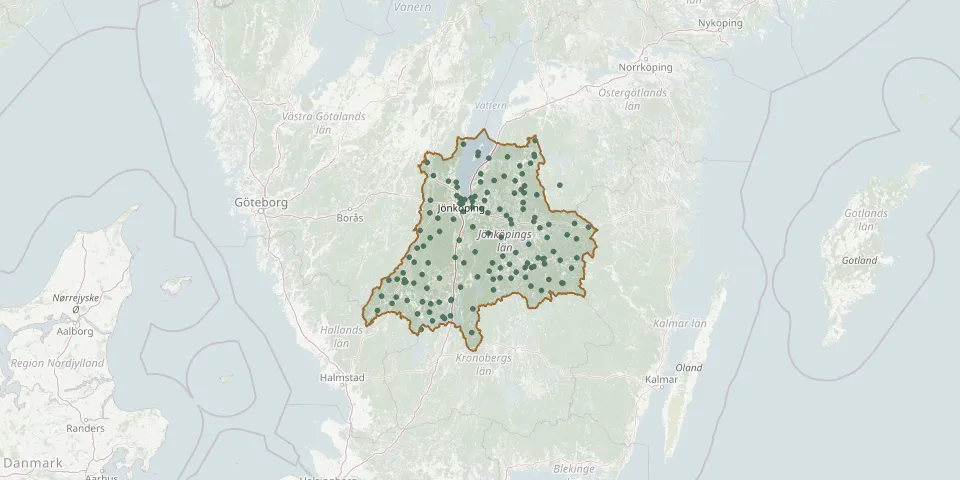 © OpenStreetMap
- Hjälmseryd ChurchyardGPS coordinates: 57.24527° N, 14.51580° E
- Hjälmseryds old churchyardGPS coordinates: 57.30780° N, 14.51290° E
- Höreda ChurchyardGPS coordinates: 57.61289° N, 15.02568° E
- Hult ChurchyardGPS coordinates: 57.63132° N, 15.12286° E
- Hultsjö ChurchyardGPS coordinates: 57.31560° N, 14.71191° E
- Huskvarna ChurchyardGPS coordinates: 57.78785° N, 14.27261° E
- Hylletofta ChurchyardGPS coordinates: 57.40490° N, 14.50673° E
- Järstorps ChurchyardGPS coordinates: 57.80259° N, 14.11495° E
- Jönköping Castle CemeteryGPS coordinates: 57.78352° N, 14.15523° E
- Jönköping Dunkehalla ChurchyardGPS coordinates: 57.78710° N, 14.14610° E
- Jönköping East CemeteryGPS coordinates: 57.77760° N, 14.20325° E
- Jönköping Woodland CemeteryGPS coordinates: 57.75479° N, 14.14767° E
- Källeryds ChurchyardGPS coordinates: 57.40932° N, 13.64323° E
- Kärda ChurchyardGPS coordinates: 57.17231° N, 13.91997° E
- Kävsjö ChurchyardGPS coordinates: 57.31466° N, 13.92205° E
- Korsberga ChurchyardGPS coordinates: 57.30682° N, 15.12390° E
- Kråkshult ChurchyardGPS coordinates: 57.54712° N, 15.42955° E
- Kulltorps ChurchyardGPS coordinates: 57.25606° N, 13.78515° E
- Kumlaby ChurchyardGPS coordinates: 58.05529° N, 14.34844° E
- Lekeryds ChurchyardGPS coordinates: 57.77279° N, 14.41736° E
- Lemnhult ChurchyardGPS coordinates: 57.28788° N, 15.26771° E
- Lemnhult Old ChurchyardGPS coordinates: 57.28498° N, 15.27723° E
- Linderås ChurchyardGPS coordinates: 57.97569° N, 14.80449° E
- Ljungarums ChurchyardGPS coordinates: 57.75471° N, 14.17634° E
- Lommaryd ChurchyardGPS coordinates: 57.88786° N, 14.75284° E
- Malmbäck New CemeteryGPS coordinates: 57.58074° N, 14.46162° E
- Malmbäck Old ChurchyardGPS coordinates: 57.58025° N, 14.46171° E
- Månsarps ChurchyardGPS coordinates: 57.66237° N, 14.07786° E
- Marbäck ChurchyardGPS coordinates: 57.85925° N, 14.85695° E
- Mellby ChurchyardGPS coordinates: 57.55609° N, 15.10803° E