
Basel-Landschaft
56 known cemeteries in Basel-Landschaft, Switzerland.
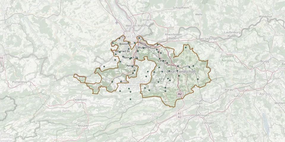 © OpenStreetMap
- Aesch CemeteryGPS coordinates: 47.46561° N, 7.59714° E
- Allschwil CemeteryGPS coordinates: 47.55370° N, 7.53710° E
- Arboldswil CemeteryGPS coordinates: 47.41680° N, 7.71690° E
- Augst CemeteryGPS coordinates: 47.53392° N, 7.71399° E
- Basel-Sankt Margarethen CemeteryGPS coordinates: 47.53949° N, 7.57918° E
- Beinwil CemeteryGPS coordinates: 47.36284° N, 7.58779° E
- Biel-Benken CemeteryGPS coordinates: 47.50376° N, 7.51977° E
- Birsfelden CemeteryGPS coordinates: 47.55474° N, 7.62799° E
- Blözen CemeteryGPS coordinates: 47.51874° N, 7.70959° E
- Bretzwil CemeteryGPS coordinates: 47.39813° N, 7.65510° E
- Brislach CemeteryGPS coordinates: 47.41805° N, 7.54380° E
- Bromhübel CemeteryGPS coordinates: 47.49100° N, 7.61858° E
- Bubendorf CemeteryGPS coordinates: 47.44935° N, 7.73449° E
- Büren CemeteryGPS coordinates: 47.44936° N, 7.66805° E
- Burg im Leimental BL CemeteryGPS coordinates: 47.45894° N, 7.44521° E
- Büsserach CemeteryGPS coordinates: 47.38830° N, 7.53970° E
- Duggingen CemeteryGPS coordinates: 47.45276° N, 7.60686° E
- Ettingen CemeteryGPS coordinates: 47.48064° N, 7.54070° E
- Fehren CemeteryGPS coordinates: 47.39611° N, 7.58085° E
- Fiechten CemeteryGPS coordinates: 47.48959° N, 7.58589° E
- Frenkendorf Äussere Egg CemeteryGPS coordinates: 47.51097° N, 7.71636° E
- Füllinsdorf CemeteryGPS coordinates: 47.50798° N, 7.72863° E
- Gelterkinden CemeteryGPS coordinates: 47.46403° N, 7.86014° E
- Grellingen CemeteryGPS coordinates: 47.44480° N, 7.59950° E
- Hölstein CemeteryGPS coordinates: 47.42184° N, 7.77055° E
- Kilchberg CemeteryGPS coordinates: 47.42606° N, 7.89962° E
- Lampenberg CemeteryGPS coordinates: 47.42792° N, 7.76160° E
- Laufen BL CemeteryGPS coordinates: 47.41756° N, 7.50365° E
- Lausen CemeteryGPS coordinates: 47.47679° N, 7.75786° E
- Lauwil CemeteryGPS coordinates: 47.39096° N, 7.67491° E